Reviewed by our editorial team Updated
The Faroe Islands reward drivers in a way few other European destinations can match. This is an archipelago of eighteen islands scattered across the North Atlantic roughly halfway between Iceland and Norway, and seventeen of them are now linked by a genuinely remarkable network of tunnels, bridges and causeways that make a self-drive road trip the only realistic way to see the country properly. Public buses exist and are cheap, but they run on a limited timetable built for residents commuting to work, not for a visitor chasing a waterfall at golden hour or a puffin colony at dawn.
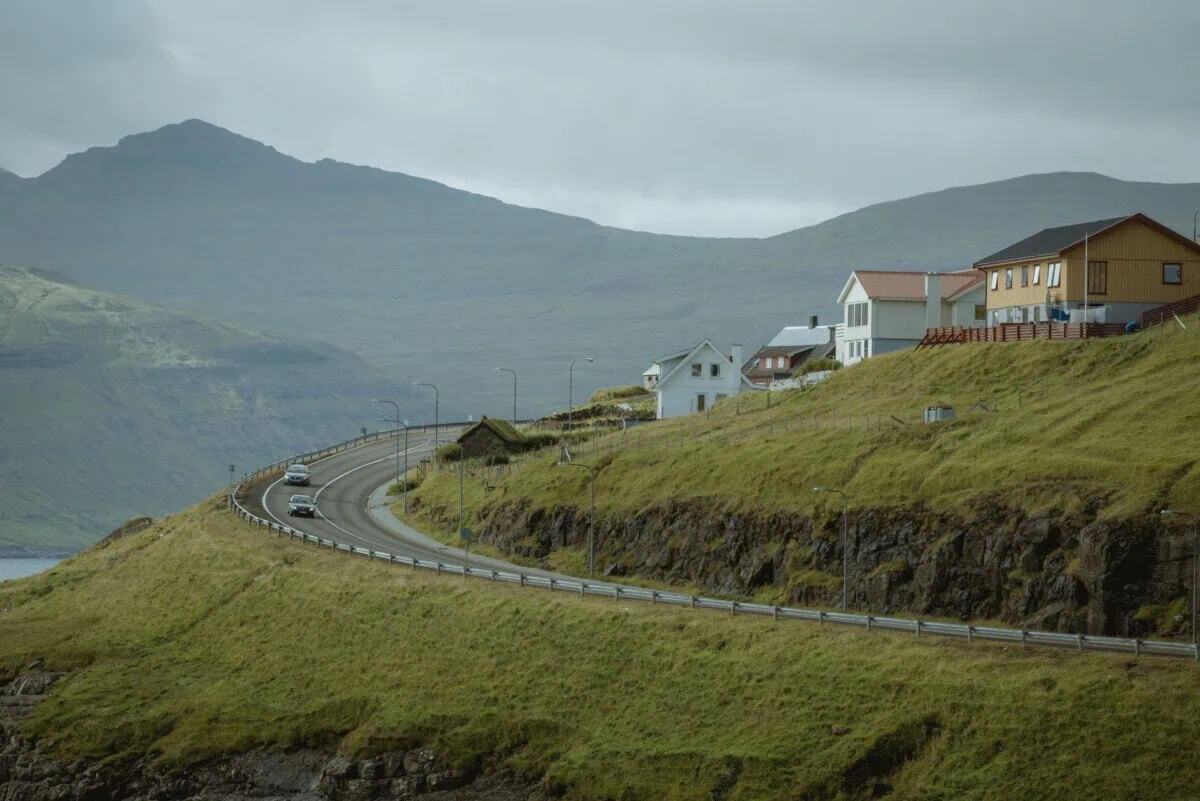
What makes this different from a routine rental-car afterthought is that the driving itself is part of the experience, and part of the planning. Faroese roads run through sub-sea tunnels that plunge more than a hundred metres beneath the ocean floor, along single-track mountain passes with no barrier between the tarmac and a sheer drop to the sea, and onto car ferries for the handful of islands the tunnels do not reach. Wind here is not a minor inconvenience either; it is a genuine driving hazard that has been known to affect exposed stretches of road, and it deserves real respect rather than a passing mention in a packing list.
None of this should put a visitor off. It should simply be planned for properly, the same way a first-time skier plans for a black run rather than assuming any slope is the same as any other. This guide covers the tunnel network and what it actually costs to use, how to handle a single-track road without causing a queue of angry locals, which islands still need a ferry booking, what the wind and weather genuinely mean for a day’s driving, and two full route itineraries covering the north and the west of the country. Alongside this guide, separate pages on the site cover the best things to do once you have arrived and how to arrange transfers from the airport, so this one focuses purely on getting behind the wheel and making sense of the road network itself.
Faroe Islands Self-Drive at a Glance
| Category | What to Expect |
|---|---|
| Territory | Self-governing Danish territory, part of the Kingdom of Denmark |
| Islands linked by road | 17 of 18 islands connected by tunnel, bridge, causeway or ferry |
| Driving side | Right-hand side, standard European rules of the road |
| Toll tunnels | Four sub-sea/mountain tunnels tolled automatically by number-plate camera |
| Ferries still needed | Suðuroy, Kalsoy and Nólsoy, among a few smaller islands |
| Typical speed limits | 50 km/h (31 mph) through villages, 80 km/h (50 mph) on the open road |
| Minimum rental age | Usually 20 to 21, varies by hire company |
| Best months to self-drive | Late May to September for daylight and calmer conditions |
Keep this table as a quick reference while reading the rest of the guide, since almost every figure in it gets explained in more detail in the sections below, from what those tolls actually cost to why the wind matters as much as the scenery.
The Sub-Sea Tunnel Network: Bridges, Tunnels and Tolls
The single biggest reason the Faroe Islands work as a self-drive destination at all is the tunnel network built over the past two decades to stitch the archipelago together. The most famous of these is the Eysturoyartunnilin, an 11.4 kilometre (7.1 mile) tunnel opened in 2020 that connects the capital island of Streymoy to Eysturoy, and it contains what its builders and local tourism boards genuinely describe as the world’s first underwater roundabout. Lit with coloured artwork by the Faroese artist Tróndur Patursson and set more than 70 metres below the seabed, the roundabout has become one of the most photographed stops on the entire road network, even though drivers are only passing through it rather than stopping.
The Sandoyartunnilin, opened in 2023, runs 10.8 kilometres (6.7 miles) from Streymoy’s Gamlarætt ferry port to the island of Sandoy, dropping to around 155 metres below the ocean floor at its deepest point and finally ending Sandoy’s dependence on a car ferry for daily life. Two further toll tunnels, the Vágatunnilin linking Streymoy to Vágar (home to the country’s only airport) and the Norðoyatunnilin connecting Eysturoy to the northern island of Borðoy, use the same automatic system.
None of the four toll tunnels use a manual booth. Instead, a camera photographs each vehicle’s number plate as it passes through, and the toll is billed automatically, typically added straight to a rental car’s final invoice or, for a private vehicle, payable online afterwards through the official Tunnil.fo payment portal. Expect to pay in the region of 175 DKK (£20/€23/$25) for a one-way pass through the Eysturoy tunnel, with the Sandoy tunnel priced similarly per direction, so a return trip through either works out to roughly double.
Practically, this means a driver never needs cash, a ticket or even to slow down at a barrier; the only real requirement is making sure a hire car’s plate is correctly registered against the rental agreement so the toll actually reaches the right invoice rather than becoming a dispute weeks later.
Best if you want daily housekeeping and a front desk. Filter by area first, then by price.
Check availabilityBest for groups who want one address and separate bedrooms rather than three hotel rooms.
See holiday homesBest for double-checking. Runs the same search across several booking sites so you are not leaving money behind.
Compare pricesSingle-Track Roads and Faroese Driving Etiquette
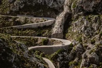
Away from the main tunnel routes, a genuine part of Faroese driving is the single-track road, most common on the way into the smaller, more remote villages such as Saksun, Tjørnuvík and much of Kalsoy. These roads carry traffic in both directions on one narrow lane, with regularly spaced passing places, small widened pull-outs at the roadside, built specifically for two vehicles to pass each other safely.
The etiquette is straightforward once it clicks: whichever driver reaches a passing place first, or has one on their own side of the road, pulls in and waits, letting the oncoming car continue past before rejoining the road. A driver heading downhill on a sloped single-track stretch is generally expected to give way to one heading up, since starting again from a standstill is harder on an incline, though in practice most locals simply pull in at whichever passing place comes first regardless of gradient.
A friendly wave or a nod through the windscreen after pulling in, or after being let through, is standard courtesy and genuinely appreciated on a network of roads used daily by a small resident population who notice a visitor driving badly far more than a visitor driving carefully. Never park directly in a passing place, even briefly for a photo, since blocking one on a single-track road with a sheer drop on one side can genuinely strand another driver with nowhere to go.
Headlights are required at all times while driving in the Faroe Islands, day or night, a rule that matters as much on these narrow village lanes as it does inside the tunnels, since it is often the only way an oncoming driver spots a car in time on a bend with no verge to see around.
The same passing-place logic applies inside the country’s single-lane mountain tunnels, of which there are around twenty scattered across the smaller islands, including all four of the short tunnels carrying the road out to Kalsoy’s northern villages. Regularly spaced pull-outs marked with an M sign sit roughly every 100 metres inside these tunnels, and the same rule applies: whoever is closer to one pulls in and waits for the oncoming car to pass.
A short flash of the headlights on approach is common local practice inside a tunnel, essentially signalling “I see you, go ahead” or the reverse, and it is worth adopting rather than assuming the other driver has already spotted you. Because these tunnels can run for well over a kilometre with no lighting and only a gentle curve to break the view ahead, entering slowly enough to reach the next M sign safely matters far more than making good time.
Locals also expect a visiting driver to give way to anything bigger: a bus, a lorry or a farm vehicle. On the open single-track roads outside the tunnels this simply means being the one who pulls into the nearest passing place rather than expecting a heavier vehicle to reverse, and it is treated as basic courtesy rather than an official rule.
Ferries to the Islands the Tunnels Don’t Reach
Even with the tunnel network, a handful of islands still depend on a car ferry and almost certainly will for years to come, since a subsea tunnel to them would be a far bigger engineering undertaking than the routes already built. The most significant is Suðuroy, the southernmost of the main islands, reached by a roughly two-hour crossing from Tórshavn that carries both cars and foot passengers, with a car under 5.5 metres costing in the region of 229 DKK (£26/€31/$33) each way at the standard fare, less if booked online in advance.
Kalsoy, the dramatic, narrow island famous for the Kallur lighthouse walk, is reached by a short car and passenger ferry from Klaksvík on Borðoy, with a return car fare of around 336 DKK (£39/€45/$49) at the standard rate. This crossing runs a limited number of sailings a day and can genuinely fill up in peak summer, so booking a specific departure ahead of time through the operator’s own official SSL booking system is worth doing rather than turning up and hoping for space.
Nólsoy, the small island visible from Tórshavn’s own harbour, technically also runs a car ferry, but its village is compact and easily walkable, so most visitors leave the car behind and travel as foot passengers on the roughly twenty-minute crossing instead. All of these routes are operated by the same national ferry and bus operator, and fares are consistently cheaper booked online in advance than paid at the dock, with a further discount for Faroese residents that visitors will not qualify for.
Building a ferry crossing into a road trip itinerary means treating it like a flight rather than a bus: arrive with time to spare, check the schedule the night before for any weather-related changes, and never plan a ferry island as a rushed final stop before catching a flight home.
Weather, Wind and Driving Safety
Wind is the single biggest variable in Faroese driving, and it deserves to be taken seriously rather than treated as scenic backdrop noise. The islands sit fully exposed to North Atlantic weather systems, and while a normal day might bring a stiff, steady breeze that barely affects driving, a genuine storm can bring gusts strong enough to be dangerous; during Storm Ingunn in January 2024, a weather station on the islands recorded gusts of around 155 mph (249 km/h), conditions in which local advice is simply to stay off the road entirely, not to drive cautiously.
Day-to-day, the more realistic hazard is a strong crosswind on an exposed causeway, bridge, or open coastal stretch, particularly around headlands and the narrower island connections, where a sudden gust can genuinely push a light rental car toward the centre line or verge. Slowing down well before a known exposed section, keeping both hands on the wheel, and being ready for a gust rather than surprised by one is standard local practice, and rental companies will generally brief visitors on which specific stretches are worth extra caution.
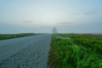
Thick fog, locally sometimes called Faroese fog, can also descend with very little warning, cutting visibility on mountain roads to a few car lengths within minutes. Checking a local forecast the morning of a drive, rather than relying on a forecast checked days earlier, is genuinely worth the two minutes it takes, since Faroese weather can shift meaningfully within a single day in a way that catches first-time visitors off guard.
None of this is a reason to avoid driving here; thousands of visitors do it safely every summer. It is simply a reason to build in flexibility, avoid pushing on through a road genuinely closed by weather, and treat a forecast warning of high winds as a real instruction to delay a route rather than a suggestion.
There is no single published wind-speed number that tells a visitor exactly when to stop driving, and it would be dishonest to invent one. Faroese ferry captains instead make that call using real-time anemometer readings from Landsverk, the national road and infrastructure authority, alongside sea-state and forecast data, rather than a fixed cut-off, and the practical version for a driver without that instrumentation is to treat an official gale or storm warning from the Faroese Met Office as a genuine instruction to stay off exposed roads that day, not merely a note to drive carefully.
Day to day, the more useful personal threshold is simpler: if a car is visibly rocking in a car park, or a forecast shows sustained wind well above what already felt strong on an earlier day of the same trip, that is the moment to delay rather than push on to a coastal viewpoint. The same logic applies to sudden fog, since pulling into the nearest safe passing place and waiting it out for ten or fifteen minutes is standard local practice rather than an overreaction, and it very often clears as quickly as it descended.

What to Do If a Road or Ferry Is Closed
A cancelled sailing or a closed mountain pass is a genuine possibility on a Faroese road trip, and the right response is always the same: check the official source rather than guess. Landsverk, the road authority, publishes live road and weather conditions for the whole network, while SSL’s own route overview is the only reliable place to confirm whether a specific sailing, such as the Kalsoy or Suðuroy crossing, is actually running that day. Our full Faroe Islands Ferry Routes guide breaks down pricing, frequency and booking for every inter-island crossing covered on this page.
In practice, cancellations are the exception rather than the norm. SSL’s own guidance is that weather-related cancellations are typically limited to a handful of routes each year, most often at harbours exposed to swell such as Nólsoy, Skopun and Svínoy, rather than a routine occurrence across the network, and staff at the terminal will rebook affected passengers onto the next available crossing if a sailing is called off.
For a closed road, the same principle holds: a genuinely storm-closed mountain pass or tunnel approach reopens once conditions ease, usually within hours rather than days, so the sensible response is to wait it out in the nearest town rather than attempt a detour on unfamiliar single-track roads in the same weather. Building one spare, unplanned day into any itinerary longer than three days, exactly as Rupert suggests in the tips box below, is what turns a cancelled Kalsoy ferry from a ruined day into a minor reshuffle.
Car Hire in the Faroe Islands
A rental car in the Faroe Islands is a genuinely modest vehicle for most itineraries, since none of the tunnel routes, main roads or even most single-track village lanes require four-wheel drive. A small hatchback typically costs somewhere in the region of 600 to 800 DKK (£69 to £92/€80 to €107/$87 to $116) a day, while a larger SUV or 4×4, worth considering mainly for extra ground clearance on a handful of rougher farm-track style approaches, runs closer to 900 to 1,100 DKK (£103 to £126/€120 to €147/$120 to $160) a day.
Most hire companies set a minimum driver age of around 20 to 21, sometimes with a young-driver surcharge below 25, and the fleet across the whole country is genuinely limited, numbering in the low thousands of vehicles in total. Booking a car well ahead of a summer visit is worth doing for that reason alone, since a popular week can sell out the smaller, cheaper cars first and leave only pricier options by the time a late booker looks.
Tunnel tolls are typically billed automatically to the card on file after the rental ends, which is worth knowing in advance so a final statement showing a handful of small toll charges does not come as a surprise. A separate page on this site covers airport transfer options for anyone who would rather arrange a pre-booked private transfer for part of a trip and only self-drive for the road trip stretches described in this guide, which is a genuinely common way visitors split their time.
On the choice of size, smaller is almost always the better call. A compact hatchback fits comfortably through the narrowest of the country’s single-lane mountain tunnels and squeezes into the small, informal parking areas at trailheads like Trøllanes or Saksun far more easily than an SUV, and the extra ground clearance of a 4×4 is rarely needed on roads that are, without exception, sealed tarmac.
On transmission, the honest answer is that manual gearboxes dominate the Faroese rental fleet, much as they do across most of Europe, and automatics exist in smaller numbers at every major operator rather than being unavailable outright. Anyone who needs an automatic should book it as early as possible, since the limited automatic allocation tends to sell out first in peak summer weeks, often at a noticeably higher price by the time only the last few remain.
Fuel and Refuelling on the Road
Petrol stations are spread fairly evenly across the inhabited islands, with the two main Faroese fuel brands, EFFO and Magn, running most of the network, and no point on the main road system is normally more than around 15 kilometres from a station. That said, several of these stations, especially in smaller villages, are genuinely unstaffed and card-only self-service, in keeping with common practice across the wider Nordic region.
International Visa and Mastercard cards are widely accepted at these pumps, but it is worth knowing that an occasional machine can reject a specific card type or a mobile wallet, and there is rarely a staff member on hand to help troubleshoot outside the larger stations in Tórshavn and Klaksvík. Carrying a second card as a backup, and topping up before the tank drops below roughly a third full rather than waiting until it is nearly empty, avoids being caught out on a remote stretch with no realistic detour to another station.
Fuel prices broadly track the wider Danish and Nordic market rather than sitting dramatically higher or lower, so a visitor budgeting for a week’s driving should expect costs roughly comparable to filling up in mainland Denmark or Norway. Given how compact the road network is overall, even a full week covering multiple islands rarely means more than one or two genuine refuelling stops.
Best if you can move a day either way. Shows how the fare changes across the month.
Compare flightsBest for short trips. Install the eSIM at home and arrive with working data, no shop queue.
Browse eSIMsBest if you would rather not work out the transport on arrival. Book it now and forget it.
View transfersRoute One: The Northern Islands Loop via Eysturoy and Kalsoy
Starting from Tórshavn, this route heads north through the Eysturoyartunnilin, giving an early chance to drive the famous underwater roundabout before the road climbs back to daylight on Eysturoy. The first proper stop is Gjógv, a village built around a dramatic natural sea gorge that boats once used as a harbour, reached along a scenic final stretch with sweeping views back over the island’s northern coastline.
From Gjógv, the route loops back south and crosses the Norðoyatunnilin to Klaksvík, the country’s second-largest town and the gateway to the northern islands, a good spot to break for lunch and top up on fuel before the day’s real highlight. From Klaksvík’s harbour, drivers take the short car ferry across to Kalsoy, an island barely wide enough for its single-track spine road, which threads through several short mountain tunnels connecting a handful of tiny villages.
The road on Kalsoy ends at Trøllanes, from where a genuinely strenuous but rewarding hike leads out to the Kallur lighthouse, one of the most photographed viewpoints anywhere in the Faroe Islands, with the neighbouring islands of Kunoy and Eysturoy laid out across the water below. Returning to Klaksvík on a later ferry sailing and driving back to Tórshavn via Eysturoy completes a loop that, including the hike, comfortably fills a full day and is genuinely one of the best single days of driving anywhere in the North Atlantic.
Route Two: The Western Loop to Gásadalur and the Mykines Viewpoints
This route starts on Vágar, the island home to the country’s only airport, reached from Tórshavn through the toll-charged Vágatunnilin. A short drive from the airport leads to Sørvágsvatn, the country’s largest lake, famous for an optical illusion that makes it appear to hang far above the ocean when viewed from the cliffs at Trælanípa, reached by a roughly ninety-minute round-trip hike from the small car park at Miðvágur.
From there, the road continues to Gásadalur, a village that was accessible only by a mountain footpath or helicopter until a 1.4 kilometre (0.9 mile) unlit tunnel opened in 2006, and it remains one of the most dramatic short drives on the whole network. A two-minute walk from the village leads to the country’s most photographed sight, the Múlafossur waterfall, which drops around 30 metres (98 feet) directly into the North Atlantic beside a scattering of turf-roofed houses.
The island of Mykines itself, home to one of the country’s largest puffin colonies and reachable only by a scheduled boat or helicopter from Sørvágur, cannot be driven to directly, which is worth knowing before building a full day around it. Most self-drive visitors instead park at Sørvágur harbour and either book a seasonal passenger boat across for the day or simply enjoy the Mykines-facing viewpoints from the mainland road, before finishing the loop back through Vágar towards Tórshavn or onward to the airport.
The 3-Day Self-Drive Itinerary
Three days is enough to combine a taste of both routes above into one compact loop, provided the pace stays realistic. It works best as Vágar first, north second, using Tórshavn as a base rather than moving accommodation every night.
| Day | Focus | Drive Time | Overnight |
|---|---|---|---|
| Day 1 | Arrive at Vágar, Múlafossur and Gásadalur, then the Sørvágsvatn/Trælanípa hike near Miðvágur before heading to the capital | Around 1 hour 15 minutes in total | Tórshavn |
| Day 2 | Route One in full: Eysturoyartunnilin to Gjógv, on to Klaksvík, then the Kalsoy ferry and the Kallur Lighthouse hike from Trøllanes | Around 2.5 to 3 hours of driving, plus the ferry and the hike | Klaksvík |
| Day 3 | Back through Streymoy via Saksun (or Tjørnuvík) for a last coastal stop, then on to Vágar for departure | Around 3 to 3.5 hours in total, so plan an afternoon or evening flight | Fly out / near Vágar |
This itinerary leans on the two routes described above rather than inventing new ground, simply linking them with an overnight in Klaksvík so the Kalsoy ferry and the Kallur hike do not have to be squeezed into a single round trip from the capital. The final day is genuinely a full day behind the wheel, which is worth knowing before booking an early flight home.

The 5-Day Self-Drive Itinerary
Five days is where a Faroese road trip starts to feel unhurried, with enough slack to add Sandoy and a proper day trip to Suðuroy without cutting the northern loop short. For the wider trip-planning picture, including how many days different attractions genuinely need, our Faroe Islands Explained hub is worth reading alongside this itinerary.
| Day | Focus | Drive Time | Overnight |
|---|---|---|---|
| Day 1 | Vágar arrival, Múlafossur, Gásadalur and the Sørvágsvatn/Trælanípa hike | Around 1 hour 15 minutes | Tórshavn |
| Day 2 | Route One: Eysturoy, Gjógv, Klaksvík, the Kalsoy ferry and the Kallur Lighthouse hike | Around 2.5 to 3 hours, plus the ferry and hike | Klaksvík |
| Day 3 | Klaksvík back to Tórshavn, then a scenic loop out to Saksun for the tidal lagoon | Around 1 hour back to Tórshavn, plus around 1 hour 40 minutes return to Saksun | Tórshavn |
| Day 4 | Suðuroy day trip by ferry, exploring Tvøroyri and the south of the island | The ferry (2 hours 5 minutes each way) dominates the day; modest driving once on the island | Tórshavn (return by evening ferry) |
| Day 5 | Sandoy in the morning via the Sandoyartunnilin tunnel, then on to the airport | Around 1 hour on Sandoy, plus 45 minutes to Vágar | Near Vágar / fly out |
Suðuroy genuinely deserves its own day rather than a rushed add-on, and the ferry crossing itself, at just over two hours each way, is long enough that the island’s own single main road only needs a modest amount of driving once you are actually on it. Keeping Sandoy for the final morning works well precisely because the tunnel makes it a 30-minute hop each way, leaving enough of the day free for the drive back to Vágar Airport.
The 7-Day Self-Drive Itinerary
A full week is enough to stop rationing the weather-dependent stops and actually build a spare day around them, which is exactly what a first-time visitor to the Faroe Islands should do. This version adds Mykines, the Slættaratindur summit hike, and an overnight on Suðuroy itself rather than a single long day trip.
| Day | Focus | Drive Time | Overnight |
|---|---|---|---|
| Day 1 | Vágar arrival, Múlafossur, Gásadalur and the Sørvágsvatn/Trælanípa hike | Around 1 hour 15 minutes | Tórshavn |
| Day 2 | Mykines boat day from Sørvágur, weather permitting | Minimal driving; the crossing and hiking dominate the day | Tórshavn |
| Day 3 | Route One: Eysturoy, Gjógv, Klaksvík, the Kalsoy ferry and the Kallur Lighthouse hike | Around 2.5 to 3 hours, plus the ferry and hike | Klaksvík |
| Day 4 | Slættaratindur hike from the Eiðisskarð pass on the way back from Klaksvík, then on to Saksun | Around an hour back to Tórshavn, plus around 1 hour 40 minutes return to Saksun | Tórshavn |
| Day 5 | Ferry to Suðuroy, exploring Tvøroyri and the south of the island | The ferry (2 hours 5 minutes) dominates; modest local driving | Tvøroyri |
| Day 6 | More of Suðuroy in the morning, then the ferry back to Tórshavn | The ferry (2 hours 5 minutes) dominates; modest local driving | Tórshavn |
| Day 7 | Sandoy via the tunnel, then on to Vágar for departure | Around 1 hour on Sandoy, plus 45 minutes to Vágar | Near Vágar / fly out |
Building in a genuine spare day around Mykines matters more than almost anything else on this list, since the crossing is cancelled often enough that a week gives real room to try again if Day 2 does not work out. Overnighting in Tvøroyri on Suðuroy rather than day-tripping it also means the two-hour crossing only has to be made once in each direction across the whole week instead of twice in a single day.
Tunnel and Ferry Costs for a Sample 5-Day Trip
Tallying up tunnel tolls and ferry fares before setting off avoids an unpleasant surprise on the final invoice, so here is a realistic breakdown for the 5-day itinerary above, using the toll rates published on Tunnil.fo and the standard car fares on SSL’s own site. Costs are shown per day and assume a standard car under 5.5 metres, since larger vehicles pay more on the ferries.
| Day | Tunnels & Ferries Used | Cost (one car) |
|---|---|---|
| Day 1 | Vágatunnilin, one-way (airport to Tórshavn) | 50 DKK (£6/€7/$7) |
| Day 2 | Eysturoyartunnilin one-way, Norðoyatunnilin one-way, Kalsoy ferry return | 561 DKK (£65/€75/$81) |
| Day 3 | Norðoyatunnilin one-way, Eysturoyartunnilin one-way (Klaksvík back to Tórshavn) | 225 DKK (£26/€30/$33) |
| Day 4 | Suðuroy ferry, return | 458 DKK (£53/€61/$66) |
| Day 5 | Sandoyartunnilin return, Vágatunnilin one-way (to the airport) | 400 DKK (£46/€53/$58) |
| Total | 1,694 DKK (£195/€226/$246) |
That comes to roughly 1,694 DKK (£195/€226/$246) in tunnel tolls and ferry fares across the whole five days, on top of the rental itself and fuel, and most of that figure, the Kalsoy and Suðuroy ferry fares, comes down noticeably if booked online in advance rather than paid at the dock. A shorter trip that skips Suðuroy and Sandoy entirely, sticking to the northern and western loops only, cuts this total by more than half.
Best for solo travellers and anyone watching the budget. Dorm beds and private rooms in the same search.
Browse hostelsBest if you have ever given up on a claim. AirHelp checks whether the flight qualifies and pursues it for you.
See the benefitsBest for a day with a suitcase and nowhere to put it. Find a storage point near where you already are.
View storageParking at the Main Sights
Formal, paid car parks barely exist outside Tórshavn, and most of the country’s best-known stops rely on a small gravel or grass pull-in rather than anything resembling a multi-storey. At Múlafossur and Gásadalur there is a modest free car park right in the village, and at Saksun a slightly larger free car park with a toilet block sits beside the church, both easily big enough outside the busiest midsummer weeks.
Two spots are worth planning around more carefully. The car park at Sørvágur harbour, used for the Mykines ferry, genuinely fills up in peak season, so arriving with time to spare rather than five minutes before departure is the safer habit, and the same applies to the free parking at Trøllanes on Kalsoy, which marks the start of the Kallur Lighthouse hike and can feel tight on a clear summer afternoon when several ferry-loads of cars arrive close together.
The one rule that applies everywhere, on top of anything specific to a single car park, is never to park in a passing place for a photo, however tempting the view, since on a single-track road with a drop on one side it can genuinely leave another driver with nowhere to go. Treat every pull-out on the way to a trailhead as a passing place until it is obviously a car park, not the other way round.
The Best Scenic Roads and Viewpoints
Beyond the destinations themselves, Landsverk, the national road authority, has signposted a handful of ordinary stretches of road as official Sóljuleiðir, or “buttercup routes,” specifically because the drive itself is the point. Two worth seeking out that do not double as headline attractions elsewhere on this site are the coastal road between Tjørnuvík and Haldórsvík on Streymoy, and the Múlaleið, the narrow route out to the tiny, almost abandoned village of Múli on Borðoy.
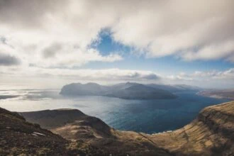
The single best short detour for a view without a hike attached is Sornfelli, a narrow, unpaved side road that branches off the main Oyggjarvegurin mountain road around 20 minutes from Tórshavn and climbs to a parking plateau beneath two large disused radar domes. On a clear evening, when cloud sits over the capital below, the plateau often sits entirely above it, giving a view over the fjord between Streymoy and Vágar that very few visitors driving straight past on the main road below ever see.
Two further stretches worth slowing down for are the road along Kaldbaksfjørður on the way out to Vestmanna, which hugs the fjord’s edge for several kilometres with the water often just below the verge, and the Eiðisskarð mountain pass on Eysturoy, the roadside parking spot that doubles as the start of the Slættaratindur hike and gives a sweeping view across the strait even for anyone with no intention of climbing higher. Neither needs a booking or a fee, and the only real preparation worth doing is checking that low cloud has not swallowed the view before setting off, since a scenic road in fog is just a road.
Roads and Tunnels Nervous Drivers May Want to Avoid
Most of the Faroese road network is genuinely unremarkable to drive: wide enough, well surfaced, and no more demanding than a rural road anywhere else in Northern Europe. A handful of specific stretches are the exception, and knowing which ones they are in advance is more useful than a vague warning to drive carefully everywhere.
The road up Kalsoy, from the ferry at Syðradalur all the way to Trøllanes, is the one most first-time visitors mention afterwards. It narrows to a single track threaded through four short, unlit mountain tunnels, with a real drop to the sea on one side in places and no verge at all, and anyone genuinely uneasy about it can leave the driving to a passenger while they enjoy the view, since the whole crossing rarely takes more than half an hour.
The Gásadalstunnilin, the short tunnel into Gásadalur, is another one drivers occasionally find unnerving purely because it is unlit and single-lane with passing bays rather than a continuous second lane, even though at only 1.4 kilometres it is over in a couple of minutes. The same is true of the approach to Saksun through the Saksunardalur valley, where the road itself is sealed and well maintained but narrows enough, with a real drop beside it in places, that a driver unused to single-track roads should expect to meet oncoming traffic and plan to give way calmly rather than brake hard at the last second.

Rupert’s Handy Travel Tips
Rupert has driven the underwater roundabout more times than he can count, and reckons a Faroese road trip rewards patience over speed.
- Book your rental car early: the whole country only has a few thousand hire vehicles, and the good ones sell out first in summer.
- Check tunnel tolls are on the invoice: the automatic camera system bills your card afterwards, so confirm your plate is registered correctly at pickup.
- Never block a passing place: even for a quick photo, since it can genuinely strand another driver on a single-track road.
- Watch the forecast the morning of your drive: Faroese weather, especially wind, can change faster than a forecast checked days earlier.
- Keep your fuel tank above a third full: some rural stations are unstaffed and card-only, and there is rarely a backup nearby.
- Build in a spare day if you can: a genuinely windy day is the day to skip Kalsoy or the ferry islands, not push through regardless.
Want to meet the reindeer behind our travel tips? Find out more in our page Who is Rupert?.





Frequently Asked Questions About Driving the Faroe Islands
Do I need a 4×4 to drive in the Faroe Islands?
No. The main roads, tunnels and most single-track village lanes are all fully driveable in a standard hatchback, and a 4×4 is only worth the extra cost for a handful of rougher farm-track style approaches.
How much does it cost to drive through the Faroe Islands tunnels?
The four toll tunnels charge in the region of 175 DKK (£20/€23/$25) per one-way pass, billed automatically by number-plate camera rather than paid at a manual booth, usually added to a rental car’s final invoice.
Which Faroe Islands still require a ferry rather than a tunnel?
Suðuroy, Kalsoy and Nólsoy are the main islands still reached by car ferry, and a subsea tunnel to any of them is not currently under construction.
Is driving in the Faroe Islands dangerous because of the wind?
Ordinary days are perfectly manageable, but genuine storms can bring extremely severe gusts, and local advice during a serious weather warning is to stay off exposed roads entirely rather than drive cautiously.
Can I reach Mykines by car?
No. Mykines has no road or tunnel connection and is reached only by a scheduled boat or helicopter from Sørvágur on Vágar, so a self-drive itinerary should treat it as a separate booked excursion rather than a driving stop.
Do I need to book ferry crossings in advance?
It is genuinely worth it for Suðuroy and especially Kalsoy, where sailings are limited and can fill up in peak summer, and booking online in advance is also cheaper than paying the standard fare at the dock.
Further Reading & Related Guides
For the wider picture beyond driving specifically, our Faroe Islands travel guide ties together the islands, healthcare, costs and where to stay in one place.
Getting to the Faroe Islands in the first place is its own small puzzle, since there are no low-cost carriers serving Vágar Airport and connections typically route through Copenhagen or a handful of other Nordic hubs; our Unusual Flight Routes Explained guide looks at exactly this kind of quirky air-bridge connection, including the Faroe Islands’ own limited flight network, and is worth reading before booking anything else.
As a self-governing part of the Kingdom of Denmark, the Faroe Islands pair naturally with a wider trip through mainland Denmark, and anyone extending a Faroese road trip with a few days exploring Copenhagen, Aarhus or Odense by rail should read our Interrail Denmark Pass Guide for how the Danish rail network and its ticketing actually work.
The Faroes are far from the only dramatic stretch of North Atlantic coastline built for a road trip. Our Wild Atlantic Way Guide to Ireland’s own coastal touring route even name-checks the Faroe Islands directly, ranking the sea cliffs of Cape Enniberg among the tallest in Europe alongside Ireland’s own Slievemore, and it is a genuinely useful comparison for anyone weighing up which North Atlantic road trip to do first.
Finally, two smaller but genuinely useful preparations before setting off: our eSIM Apps Guide covers staying connected for offline maps and weather checks on remote single-track roads where signal can be patchy, and our Travel Insurance Apps Guide is worth a look given how much of this trip genuinely depends on the weather cooperating.