
The Wales Coast Path is a continuous waymarked trail that runs for roughly 870 miles (1,400km) around the entire coastline of Wales, from the Dee estuary in the northeast to the Severn estuary in the south. It opened on 5 May 2012, making Wales the first country in the world with a dedicated path covering its whole coast.
This guide focuses on the North Wales section, the stretch that runs through Conwy, Llandudno, the Great Orme, Anglesey and Caernarfon, all towns we cover in detail elsewhere on the site. Few walkers attempt all 870 miles in one trip; most tackle it in short day sections, and that’s the approach this guide takes, focusing on the best day walks in North Wales along with waymarking, tide safety and using the railway for point-to-point routes.
Unlike a single trail through one national park, the Wales Coast Path threads through working harbours, Victorian resort towns and quiet farmland in more or less equal measure, so the character of the walking changes constantly from one section to the next. That variety is part of the appeal, and it’s rare to walk more than a few miles without the scenery shifting noticeably.
The North Wales stretch in particular benefits from running almost parallel to the North Wales Coast Line for much of its length, which opens up point-to-point walking that most of the rest of the path can’t offer as easily. Rather than an out-and-back walk, you can genuinely start at one station and finish at another.
Tide safety matters on several stretches too, particularly around the estuaries near Conwy, so this guide flags where to take extra care. Between the walking, the wildlife and the railway links, there’s enough here to fill an afternoon or several days at a slower pace.
| Section | Distance | Difficulty | Highlights |
|---|---|---|---|
| Prestatyn to Talacre | 3.5 miles / 5.5km | Easy | Point of Ayr Lighthouse, Gronant Dunes little tern colony, Offa’s Dyke Path meeting point |
| Talacre to Rhyl | 7 miles / 11km | Easy | Dee Estuary views, dune beaches, Rhyl seafront and SkyTower |
| Llandudno to Conwy (via Great Orme) | 8 miles / 13km | Moderate | Marine Drive cliffs, Snowdonia and Anglesey views, finishes at Conwy Castle |
| Llanfairfechan to Bangor | 6 miles / 9.5km | Easy to moderate | Traeth Lafan nature reserve, wading birds, views to Puffin Island |
| Bangor to Menai Bridge | 3 miles / 5km | Easy | Menai Suspension Bridge, Britannia Bridge, Belgian Promenade |
| Holyhead to South Stack | 2.75 miles / 4.25km | Moderately challenging | RSPB reserve, South Stack Lighthouse, nesting seabird cliffs |
| Llanfairpwll to Menai Bridge | 3 miles / 5km | Easy | Menai Strait views, passes under two historic bridges |
| Beaumaris to Penmon Point | 4.5 miles / 7.25km | Easy to moderate | Georgian seafront, Penmon Priory, Puffin Island views |
| Moelfre to Dulas | 4.5 miles / 7.25km | Moderate | Coastal cliffs, shipwreck memorials, quiet Anglesey coastline |
Is the Wales Coast Path Waymarked?
Every mile of the Wales Coast Path carries the same distinctive dragon-shell logo, stamped onto posts, gates and signposts from the Dee estuary to the Severn. The signage is consistent nationwide, so once you’ve learned to spot it in North Wales you’ll recognise it anywhere else on the route too.
The standard waymarker appears in blue and yellow, and it’s the version you’ll follow for the vast majority of any day walk. It’s placed frequently enough that you rarely need a map just to stay on the right track, though carrying one is still sensible for the wider picture.
Where the coast route crosses tidal ground, river estuaries or busy roads, an alternative inland path is signed instead, using the same dragon-shell design but in red and yellow. This isn’t a downgrade on the walking, it’s simply the safer option for that particular stretch, and the two colours make it obvious which version you should be following.
Around Conwy and Lavan Sands in particular, walkers need to watch for the red and yellow signs rather than pushing on along the tempting-looking sand flats. Following the correct waymarker here isn’t optional guidance, it’s the difference between a straightforward walk and getting caught out by a rising tide.
The waymarking is maintained by the same teams responsible for the wider Wales Coast Path, and reported faults are generally fixed quickly. If a sign is missing or unclear on any section, it’s worth checking the official tide times and route pages before continuing rather than guessing.
How Long Does It Take to Walk the Wales Coast Path?
Walking the entire Wales Coast Path is a serious undertaking. At roughly 870 miles (1,400km), completing every section in a single journey normally means setting aside several weeks rather than treating it as a conventional walking holiday.
The exact time depends heavily on fitness, daily mileage and how often you want to stop. Someone averaging 15 miles a day would still need close to two months if rest and sightseeing days are included, while a slower itinerary could easily stretch considerably beyond that.
That doesn’t mean you need months available to say you’ve walked the Wales Coast Path. The route works particularly well as a collection of individual day walks, and many people gradually complete sections over several visits rather than attempting everything at once.
North Wales is especially suited to this approach because of the combination of railway stations, bus connections and compact coastal towns. A three or four-hour walk can finish somewhere with food, accommodation and public transport rather than leaving you stranded on an isolated section of coastline.
Even the Anglesey portion is better thought of as a collection of walks unless you’re deliberately undertaking a long-distance challenge. The island’s coastline includes substantial distances around bays, estuaries and headlands that make the walking distance considerably greater than simply travelling between towns by road.
For a first visit, we’d choose one or two of the shorter North Wales sections rather than worrying about completing a particular mileage. The Llandudno and Great Orme route, South Stack, Menai Strait and Beaumaris sections all provide a genuine taste of the Wales Coast Path within a single day.
See hotel options and places to stay in Wales.
Browse hotelsBrowse apartments, holiday homes and self-catering stays in Wales.
View rentalsSee hotel prices from multiple booking sites in one search.
Compare ratesYou Don’t Need to Walk the Whole Thing
Very few walkers ever attempt the Wales Coast Path in one continuous trip, and there’s no expectation that you should either. Covering all 870 miles typically takes several weeks, putting it firmly in expedition territory rather than a normal day out.
Most people instead treat the path as a series of standalone day walks, picking off whichever section suits their base for that trip. That approach works especially well in North Wales, where the coastline is broken into clearly defined, manageable stretches rather than one long unbroken slog.
Conwy, Llandudno and Bangor all sit directly on both the path and the railway line, which makes sampling a short section genuinely easy. You can walk for a couple of hours, reach the next town, and simply catch a train back rather than retracing your steps on foot.
This flexibility is what makes North Wales one of the most approachable parts of the entire route. There’s no need to commit to a multi-day itinerary or arrange transport logistics, since a single afternoon is enough to experience some of the best coastal scenery on offer.
For anyone new to the Wales Coast Path, starting with one of these short town-to-town sections is the sensible way in. It gives a genuine taste of the walking without any of the planning that a longer expedition would demand.
Prestatyn to Talacre: The Path’s Eastern Gateway
Prestatyn marks the point where the Wales Coast Path meets the northern end of the Offa’s Dyke Path, making it the effective eastern gateway to the North Wales section covered in this guide. From here the route heads west along the Dee Estuary, an easy introduction rather than a baptism of fire.
The 3.5-mile (5.5km) stretch on to Talacre is one of the flattest sections of the whole path, running along dunes and wide sand where the Dee Estuary opens into the Irish Sea. It’s a genuinely easy walk, well suited to families or anyone wanting a first taste of the coast path without a single hill.
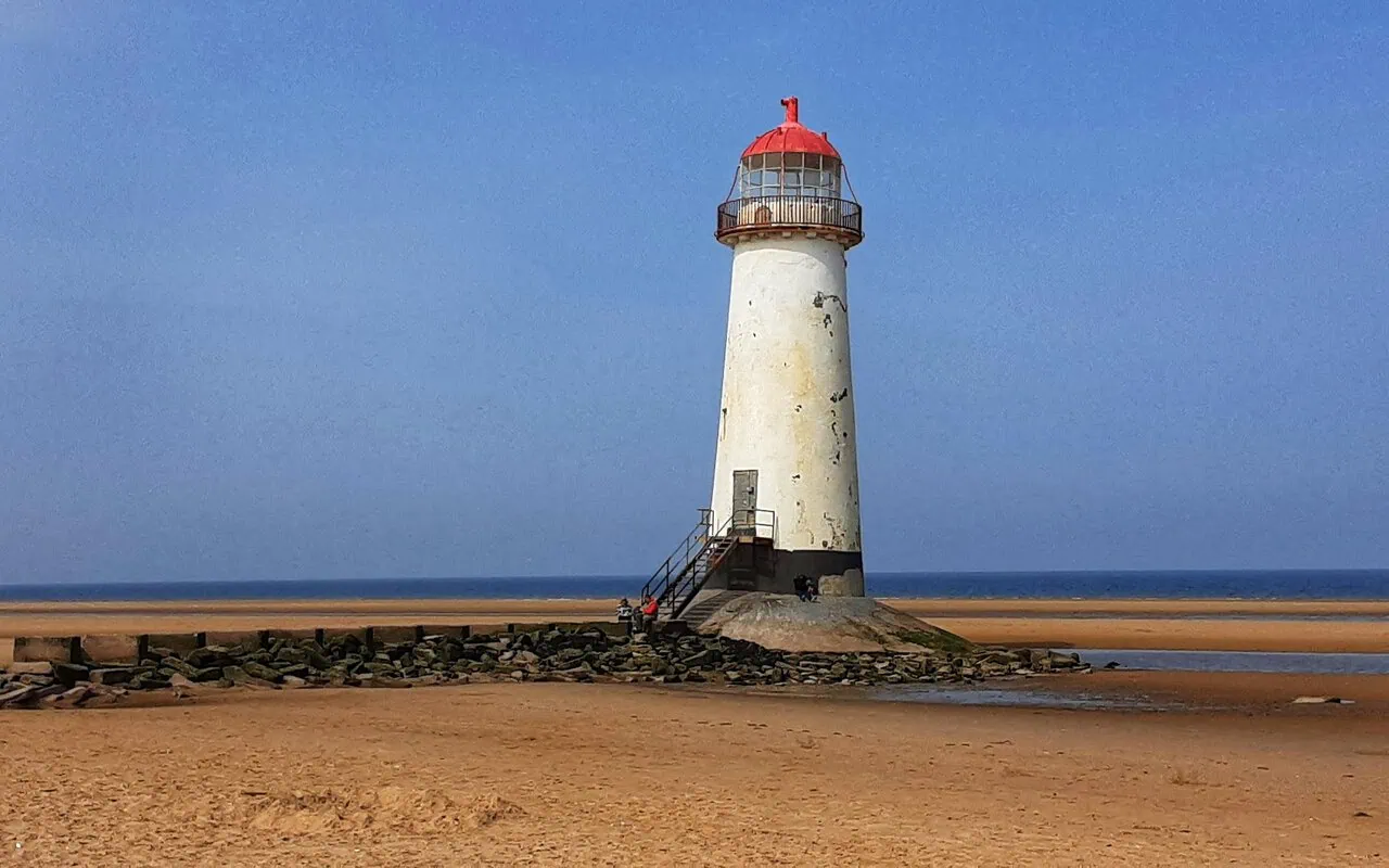
The highlight is unmistakable: Point of Ayr Lighthouse, a round brick tower built in 1776 that has stood disused since the 1880s and remains one of the most photographed landmarks on this stretch of coast. At low tide it’s possible to walk out across the sand towards it, though the surrounding flats are tidal and worth checking before venturing far.
Just inland of the beach, Gronant Dunes hold one of the UK’s most important colonies of little terns, Britain’s rarest breeding seabird, fenced off through the nesting season from May to August. A dedicated viewing area lets walkers watch the colony without disturbing it.
Both ends of this stretch sit close to the North Wales Coast Line, with Prestatyn station a short walk from the path and regular buses covering the gap to Talacre for anyone without a car. Prestatyn itself has cafés and shops for stocking up before heading out onto the open dunes.
Talacre to Rhyl: Flintshire and Denbighshire’s Seaside Towns
Continuing west from Talacre, the path swaps quiet dunes for classic Welsh seaside resort scenery, crossing from Flintshire into Denbighshire on its way to Rhyl. It’s a 7-mile (11km) stretch, flat throughout and easy to underestimate.
The route runs along a near-continuous line of promenade and beach, passing through Prestatyn’s own seafront before the coastline opens into the wide sands that define this part of North Wales. Backed by dunes and caravan parks rather than cliffs, it’s a very different mood from the Great Orme or Anglesey sections further along the path.
Rhyl itself is the obvious destination, a Victorian resort town that’s reinvented itself several times over with a rebuilt seafront, the SkyTower observation tower and a long sandy beach that still draws day-trippers in summer. It’s a livelier stop than most on this guide, with plenty of places to eat before moving on.
Along the way, the path skirts Kinmel Bay and the mouth of the River Clwyd, passing the small harbour and marina before the final approach into Rhyl. Wading birds are a regular sight on the estuary mud at low tide.
Rhyl sits directly on the North Wales Coast Line, with a station a few minutes from the seafront, making it as easy to reach by train as any other town covered in this guide. Combined with the Prestatyn to Talacre stretch, this gives a full day’s easy, flat walking along the path’s least-visited end.
Best Short Day Walks in North Wales
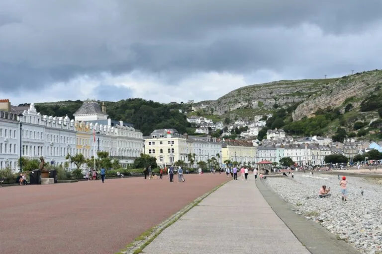
The single best introduction to walking in North Wales links Llandudno and Conwy via the Great Orme’s Marine Drive, an 8-mile (13km) route that climbs around dramatic limestone sea cliffs before dropping down to flatter ground along the Conwy estuary. It’s genuinely a walk of two distinct halves, and that contrast is part of what makes it so memorable.
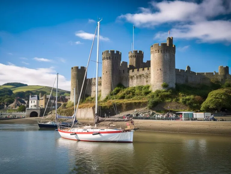
The first stretch delivers real cliff scenery, with resident wild goats a common sight scrambling across the rock above the road. The second half eases off considerably, running level past Deganwy before arriving at Conwy and finishing right beneath the walls of Conwy Castle, one of the most dramatic approaches to any town on the whole path.
On Anglesey, the short walk from Holyhead to South Stack is just as rewarding in a different way. It’s a moderately challenging 2.75-mile (4.25km) route over Holyhead Mountain, ending at the lighthouse and RSPB reserve, where thousands of nesting seabirds crowd the cliffs through spring and early summer.
Further round the island, the walk from Beaumaris to Penmon Point offers a gentler 4.5-mile (7.25km) alternative, passing a Georgian seafront and the ruins of Penmon Priory with views out to Puffin Island. It’s an easier walk than the Great Orme or Holyhead Mountain routes, with little in the way of serious climbing.
The quieter section between Moelfre and Dulas suits anyone who’d rather have Anglesey’s coastline without the crowds that gather around its better-known spots. The scenery here is subtler, but the near-total absence of other walkers on some stretches is its own reward.
Between these five routes, there’s a genuine option for most fitness levels and time budgets across North Wales. Picking two or three that fit your base for the trip is a far more realistic plan than trying to string them all together in one visit.
Newborough and Llanddwyn: One of Anglesey’s Best Coastal Walks
For a completely different side of the Anglesey coastline, head to Newborough and Ynys Llanddwyn on the southwestern side of the island. Here the coast path passes through a mixture of forest, dunes, enormous sandy beaches and one of the most distinctive headlands in Wales.
Newborough Forest provides the starting point for many walks in the area. Paths run through the pine woodland before emerging onto Traeth Llanddwyn, where the scale of the beach becomes apparent and views stretch across the water towards the mountains of Eryri.
At the western end of the beach is Ynys Llanddwyn, associated with the Welsh patron saint of lovers, St Dwynwen. Despite its name, Llanddwyn isn’t normally an island at low tide and can usually be reached on foot from the beach.
The headland contains the ruins of St Dwynwen’s Church, old pilots’ cottages and two distinctive navigation towers, while paths continue towards viewpoints overlooking the surrounding coastline. It’s one of those places where the historic features and landscape are equally important.
The coast path allows you to make this part of a considerably longer walk, but you don’t need to. A straightforward Newborough to Llanddwyn walk provides several hours of exploring without requiring a full day of long-distance hiking.
Pay attention to tides and local conditions around the headland, and don’t assume every stretch of sand that is accessible on the outward journey will remain identical later in the day. Newborough is also a nature-rich area, so follow any seasonal signs protecting wildlife or sensitive habitats.
This is one of our favourite sections for visitors who only have time for one Anglesey coastal walk. South Stack has the more dramatic cliffs, but Newborough and Llanddwyn provide a combination of mountains, forest, beach and Welsh history that’s difficult to match elsewhere on the route.
Conwy to Llanfairfechan: Along the North Wales Coast
West of Conwy, the Wales Coast Path continues between the mountains and sea towards Llanfairfechan, filling the gap between the Great Orme and the Traeth Lafan section covered later in this guide.
Leaving Conwy takes you away from the castle and medieval walls before the route continues along the coast towards Penmaenmawr. This section feels very different from the Great Orme immediately behind you, with the mountains squeezing much closer to the sea.
Penmaenmawr provides a useful stopping point, with a railway station and places to pick up food or drink before continuing west. From here the coastline opens again as you approach Llanfairfechan, with views towards Anglesey across the water.
One of the advantages of this stretch is the railway running alongside much of the route. Both Penmaenmawr and Llanfairfechan have stations, so you don’t necessarily need to walk the entire section or retrace your route afterwards.
The walking is less dramatic than the exposed cliffs around the Great Orme, but that’s part of its appeal. You’re following a narrow coastal corridor with the Carneddau mountains on one side and the Irish Sea on the other, providing a very recognisable North Wales landscape.
Continue beyond Llanfairfechan and the character changes again as the path approaches Traeth Lafan and Bangor. That makes this the missing geographical link between the Conwy walks and the Menai Strait sections rather than an isolated walk in its own right.
Compare routes and fares for your journey to Wales.
Compare flightsUse an eSIM to get online without hunting for a local SIM after arrival.
See eSIM optionsHave a private airport pickup arranged before you travel.
Book a transferLlanfairfechan to Bangor: Traeth Lafan and the Approach to Anglesey
West of Conwy, the path threads along Traeth Lafan, better known locally as Lavan Sands, on its way towards Bangor and the Menai Strait. This 6-mile (9.5km) stretch connects the Conwy and Llandudno walks covered earlier in this guide to the crossing point onto Anglesey.
Traeth Lafan is a Site of Special Scientific Interest, and the tidal flats here hold huge numbers of wading birds and wildfowl through autumn and winter, including oystercatchers, curlews and pintail. Birdwatchers regularly rate it among the best sites on the whole North Wales coast.
As mentioned earlier, this is also one of the sections where the tide genuinely matters. The official route follows the red and yellow inland waymarker around the sands rather than crossing them directly, so it’s worth budgeting slightly more time than the direct distance suggests.
The walking itself is easy and largely flat, with clear views out across the strait towards Puffin Island and the Anglesey coastline on a clear day. Llanfairfechan and Aber Ogwen both make good stopping points along the way, with a scattering of benches and information boards.
Llanfairfechan sits on the North Wales Coast Line, and Bangor at the far end is one of the best-connected stations on the whole route, making this an easy one-way walk by train. It’s the natural link between the Conwy-area walks and the Menai Strait crossing that follows.
The Menai Strait Crossing: Bangor to Menai Bridge
From Bangor, the path reaches one of the most striking short stretches anywhere on the Wales Coast Path: the crossing of the Menai Strait onto Anglesey. At just 3 miles (5km) and largely flat, it’s an easy walk built almost entirely around two extraordinary pieces of engineering.
The first is Thomas Telford’s Menai Suspension Bridge, opened in 1826 and, at the time, the longest suspension bridge in the world. Walkers pass beneath its chains before continuing along the strait to the second, Robert Stephenson’s Britannia Bridge, rebuilt as a combined road and rail crossing after a fire in 1970.
On the Anglesey side, the path passes the Belgian Promenade in Menai Bridge town, a waterside walkway built during the First World War by Belgian refugees who had settled locally to work in a nearby munitions factory. It’s a small, easily missed detail that adds real history to an otherwise scenic stroll.
Bangor’s own Garth Pier, a Grade II listed Victorian pier dating from 1896, is worth a short detour before setting off, and gives good views back across the strait towards the bridges. It’s one of the longest piers in Wales and still free to walk along.
Both Bangor and Menai Bridge are well served by bus, and Bangor railway station connects directly into the North Wales Coast Line covered elsewhere in this guide. This short crossing is the natural link between the mainland walks and the Anglesey routes described in Best Short Day Walks in North Wales.
Menai Bridge to Caernarfon: Following the Menai Strait
The Wales Coast Path doesn’t simply disappear west after reaching the Menai Strait. On the mainland side, it continues southwest towards Caernarfon, following the water separating Anglesey from mainland Wales.
The Menai Strait dominates much of this stretch. Unlike the open Irish Sea coastline elsewhere in North Wales, the relatively narrow channel means Anglesey remains visible across the water, while boats and other craft regularly pass through the strait.
The route gradually leaves the busier surroundings of Bangor and Menai Bridge behind and enters quieter stretches of coastline and countryside. There are views back towards the Menai Suspension Bridge, while the mountains of Eryri provide the backdrop inland.
Eventually the path approaches Caernarfon, where one of the most impressive finishes to any North Wales walk waits beside the water. Caernarfon Castle dominates the waterfront, with the path bringing you directly into the historic town rather than finishing on its outskirts.
Caernarfon is a particularly good place to finish because there are cafés, pubs, restaurants and accommodation within a short distance of the path. Our dedicated Caernarfon guide covers the castle and other things worth seeing if you’re staying after the walk.
Public transport requires a little more planning here than on the railway-backed sections east of Bangor. Caernarfon doesn’t have a mainline railway station, so buses become more important if you’re attempting the route as a one-way walk.
This is therefore a section where it’s worth checking your return transport before setting off rather than assuming there will be a convenient train waiting at the finish. The reward is a quieter stretch of the Menai Strait and an exceptional arrival into one of North Wales’s most historic towns.
Browse hostels and budget-friendly stays around Wales.
See hostelsFlying to Wales? Get fast compensation payouts, eligible lounge benefits and expert help when flights go wrong.
See AirHelp+ benefitsLeave your luggage somewhere convenient and enjoy Wales hands-free.
View storageWalking with the Railway: The North Wales Coast Line
Point-to-point walking is what makes the North Wales stretch of the path so practical, and it’s largely down to the North Wales Coast Line running almost parallel to the coast between Chester and Holyhead. The railway effectively turns the whole stretch into a series of one-way walks rather than out-and-back routes.
The usual approach is simple: start at one station, follow the coast path to the next town along, then catch a train back to your car or accommodation. It removes the need to retrace your steps on foot, which matters more than it sounds after a few hours of walking.
Access from the stations themselves is generally short and straightforward. Conwy station is a five-minute walk from the quay, and Llandudno station sits a similar distance from the promenade, so neither adds much extra walking to the day.
Bangor connects to the Menai Suspension Bridge in under two miles, opening up routes towards Anglesey or Caernarfon without needing a car at all. Holyhead station goes one step further, linking directly to the town and path via the Celtic Gateway footbridge.
That makes Holyhead one of the easiest stretches on the entire path to reach without your own transport. Combined with the frequency of trains along this line, it’s realistic to base yourself in one town and walk a different section each day.
For anyone planning a multi-day visit, checking timetables in advance is worth the ten minutes it takes. Our full North Wales Coast Line guide covers every connection mentioned here in more detail, including journey times between each station.
Crossing Estuaries: Tides and Safety
Several sections of the North Wales path cross estuaries and tidal sand flats, and this is the one safety issue worth taking seriously on an otherwise gentle walk. The most notable example is Lavan Sands, the wide expanse of tidal flat between Bangor and Llanfairfechan.
These areas can look entirely walkable at low tide, with firm sand stretching out for what seems like a safe distance. The problem is how quickly that changes, since the tide can turn and flood the flats faster than most walkers expect.
Checking tide times before setting out is essential for any section that crosses open sand or marsh rather than firm coastal path. It takes a couple of minutes online and removes any guesswork about whether a crossing is safe that day.
None of this is a reason to avoid these sections, since Lavan Sands and the ground around Conwy are some of the quietest and most atmospheric parts of the whole walk. It’s simply a reason to plan around the tide rather than ignore it.
Where the main coast route is affected by tides, the official red and yellow waymarker signs an inland alternative that stays clear of the risk entirely. The Wales Coast Path’s own tide times page is worth bookmarking before any visit to this stretch.
Best Free Things to Do on the Wales Coast Path
Almost everything covered in this guide costs nothing beyond the price of getting there and, if you’re doing a one-way walk, a train fare back to base. Walking any stretch of the Wales Coast Path is entirely free, which is easy to forget when so much of North Wales’s other attractions come with an admission price.
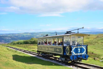
The cliff-top viewpoints at South Stack cost nothing to reach and enjoy, and the same goes for walking the Great Orme’s Marine Drive on foot rather than driving or taking the tram. Both rank among the best coastal views in North Wales, and neither requires a ticket.
The Menai Strait crossings at Llanfairpwll and Menai Bridge are free too, giving close-up views of two historic bridges without needing to pay for access. The only exception on this stretch is the RSPB visitor centre building at South Stack, which does charge for entry.
The reserve’s outdoor paths and cliff-top viewpoints around that same visitor centre remain free to use, so skipping the indoor exhibits doesn’t mean missing the seabirds. Most walkers get everything they came for simply by following the path itself.
Bring your own food and drink and there’s genuinely no cost at all beyond getting to the start of your chosen section. For a day out that delivers castles, cliffs, wildlife and coastline in equal measure, it’s hard to find better value anywhere in North Wales.

Practical Tips for Walking the Path
North Wales weather can change quickly even in the height of summer, so it’s worth packing for more than the forecast promises. A bright morning on the coast can turn wet and windy within an hour, especially on more exposed sections of cliff path.
Waterproofs and proper footwear are worth carrying even on a short walk, rather than just the longer routes. This matters most on the cliff paths around the Great Orme and Holyhead Mountain, where the ground gets uneven and genuinely exposed to the wind.
A paper map or downloaded offline route is sensible backup even where the waymarking is good, since phone signal isn’t guaranteed on every stretch of coast. Pairing that with a charged phone covers most of what you need for a straightforward day walk.
Food and water matter more than people expect, particularly on the longer day sections where there’s no guarantee of a shop or café along the way. Stopping points do exist in most towns, but it’s worth checking before setting off rather than assuming.
For any section that crosses an estuary or tidal sand, a tide table is as essential as the map itself. Between decent footwear, weatherproof layers, a route you can follow offline and an eye on the tides, most of what could go wrong on this walk is easy to plan around in advance.
Walking the Wales Coast Path with a Dog
Much of the Wales Coast Path can be enjoyed with a dog, making it a good choice for visitors who don’t want to leave their dog behind while exploring the North Wales coastline. The important thing is recognising that conditions can change substantially between sections.
Dogs should be kept under close control around livestock, and using a lead is the sensible option when crossing fields containing sheep, cattle or other farm animals. The path crosses working farmland in numerous places rather than remaining on a dedicated coastal promenade throughout.
Wildlife areas require particular care. Places such as South Stack, Gronant Dunes and other seabird nesting areas can have seasonal restrictions or requests to keep dogs on leads to prevent disturbance. Always follow the signs on the ground rather than assuming the same rules apply year-round.
Clifftop sections bring another obvious risk. The Great Orme, Holyhead Mountain and parts of the Anglesey coastline include steep or exposed drops, so even a normally reliable dog is better kept on a lead where the path runs close to an edge.
Beaches can have their own seasonal dog restrictions, particularly around popular seaside towns during the summer. These rules are often limited to particular sections of beach rather than the entire coastline, but check local signs before letting a dog off the lead.
Carry water for your dog as well as yourself, particularly on longer Anglesey sections where there may be several miles between reliable water stops. Hot weather can also make exposed coastal walking surprisingly demanding when there is little shade.
Public transport makes some one-way walks possible with a dog, but check the current operator’s rules before relying on a particular bus or train. With a little planning, though, bringing a dog doesn’t prevent you from enjoying some of the best sections covered in this guide.
Getting to the North Wales Section
The North Wales Coast Line is the easiest way to reach almost any point on this stretch of the path, running from Chester through Llandudno Junction, Conwy and Bangor before terminating at Holyhead. Connections from Manchester and further afield make it a realistic day-trip option even without a car.
Drivers have plenty of options too, with car parks available in Conwy, Llandudno and Holyhead close to the path itself. The simplest approach is to park at one end of a walk and return by train, rather than trying to arrange transport at both ends.
That train-back approach is worth building into any plan for this stretch, since it removes the need to retrace a route on foot after a full day of walking. It also opens up longer point-to-point days than most people would attempt as a there-and-back walk.
Our full North Wales Coast Line guide covers timetables and journey times between every station mentioned in this guide, from Llandudno Junction to Holyhead. It’s worth checking before travelling, particularly outside peak summer timetables when services can run less frequently.
If your walk finishes at Holyhead and you’re continuing on to Ireland, our Holyhead to Dublin Ferry guide covers every crossing option from there. It’s a natural way to extend a North Wales trip into a longer one without much extra planning.

Rupert’s Handy Travel Tips
Planning to walk part of the Wales Coast Path? Here are a few useful tips to help you make the most of it:
- Check the tide tables first: sections near Conwy and Lavan Sands cross tidal sand, so check tide times before setting out and turn back early if in doubt.
- Follow the right waymarker: the main blue and yellow dragon-shell logo marks the coast route, while red and yellow signs an inland alternative around tidal or busy sections.
- Plan a one-way walk with the train: pick two stations on the North Wales Coast Line, walk between them, and let the railway bring you back.
- Wear proper footwear: the cliff paths around the Great Orme and Holyhead Mountain are uneven in places, so trainers aren’t ideal.
- Pack for changeable weather: even a short summer walk on this coast can turn wet and windy, so bring waterproofs and extra layers.
Want to meet the reindeer behind our travel tips? Find out more in our page Who is Rupert?.
Frequently Asked Questions
How long is the Wales Coast Path?
It runs for roughly 870 miles (1,400km), continuously around the entire coastline of Wales from the Dee estuary in the northeast to the Severn estuary in the south.
When did the Wales Coast Path open?
It officially opened on 5 May 2012, making Wales the first country in the world with a dedicated waymarked path covering its entire coastline.
Do you have to walk the whole Wales Coast Path?
No. Most walkers complete short day sections rather than the full route, and North Wales, with its parallel railway line, is one of the easiest stretches to do this way.
Is the Wales Coast Path well waymarked?
Yes. The main route is marked throughout with a blue and yellow dragon-shell logo, with a red and yellow version signing alternative routes around tidal or busy sections.
Can you use the train to walk sections of the path in North Wales?
Yes. Stations at Conwy, Llandudno, Bangor and Holyhead all sit close to the path, so you can walk one way between two stations and catch a train back rather than retracing your steps.
Are there tide risks on the North Wales section of the path?
Yes. Sections near Conwy and Lavan Sands cross tidal sand flats that can flood as the tide turns, so check tide times before setting out and follow the signed alternative route where one exists.
Further Reading & Related Guides
If the Great Orme walk brings you into Conwy, our dedicated Conwy Castle guide covers the fortress in full, from its eight towers to current admission prices, while our Things to Do in Conwy guide rounds up the rest of the town, from the walls and quay to Plas Mawr, for anyone stopping longer than a quick castle visit.
For the practicalities of getting around by train, our North Wales Coast Line guide has full timetables and connections between every station mentioned here, from Llandudno Junction to Holyhead. And for the wider picture of what else North Wales and the rest of the country offer alongside the coast, our Wales Travel Guide brings together the national parks, castles and coastline that pair naturally with a day or two of walking.