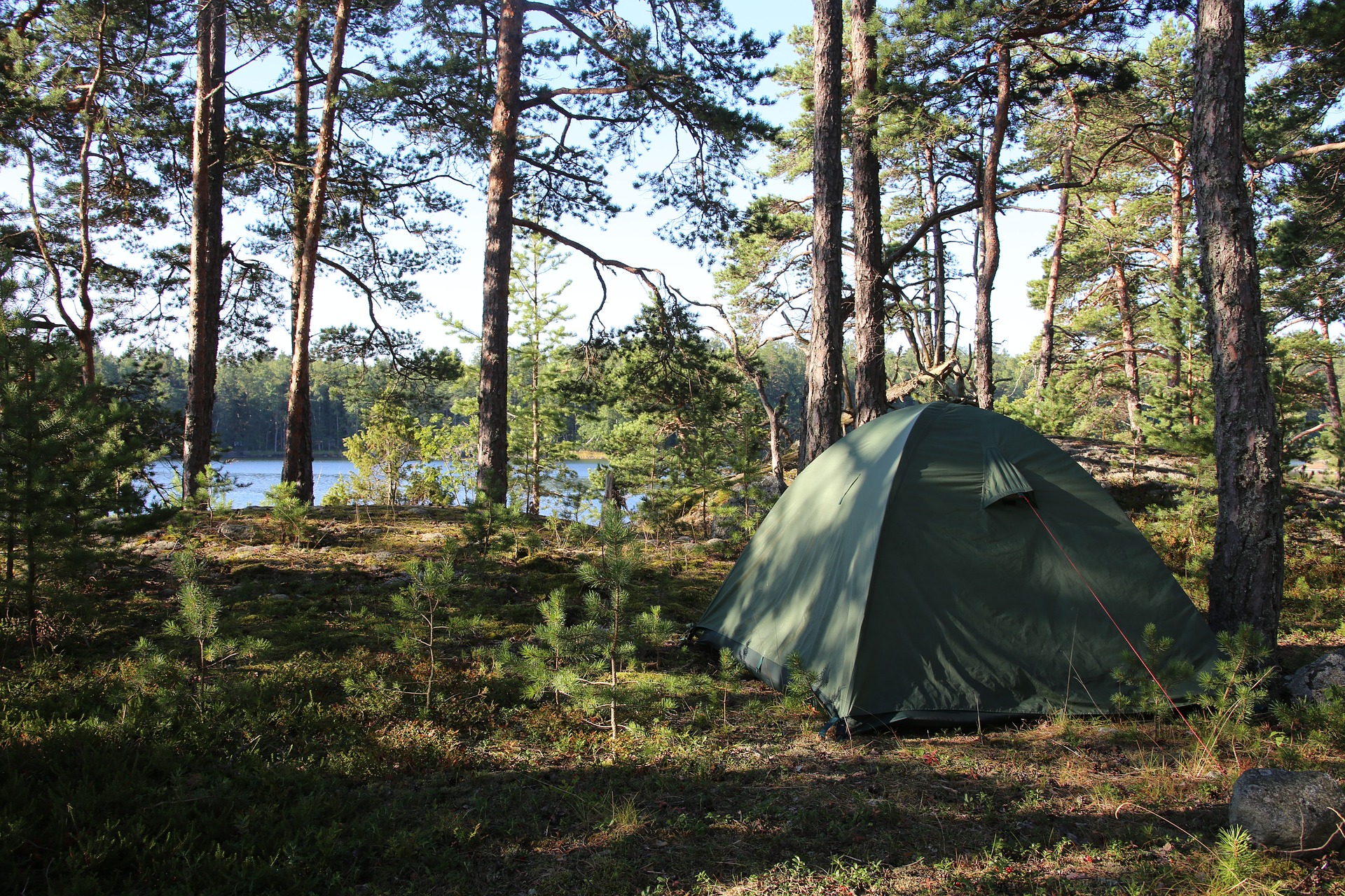
Why Camping Apps Are a Must for Outdoor Adventures
Camping in the modern era blends timeless outdoor tradition with powerful digital support. The core experience of sleeping under the stars, cooking outdoors, and disconnecting from daily life remains unchanged, yet today’s travellers benefit from tools that make every stage of the journey more efficient, safer, and significantly more enjoyable. Camping apps have become essential travel companions, offering everything from campsite discovery and navigation to packing support and even real-time stargazing.
For travellers, one of the biggest advantages is the removal of uncertainty. Instead of relying on outdated printed guidebooks or second-hand recommendations, campsite booking apps provide instant access to verified reviews, live availability, pricing details, and full facility breakdowns. This allows campers to make informed decisions before they arrive, whether they are booking a fully serviced pitch, a remote wilderness site, or a glamping retreat with modern comforts.
Navigation has also been transformed. Offline mapping apps allow you to explore remote regions confidently, even when there is no mobile signal. This is particularly important for backcountry routes, national parks, and lesser-developed areas where traditional navigation tools often fall short. At the same time, safety-focused apps provide access to first aid instructions, survival guidance, and emergency resources, ensuring that critical information is always available when needed most.
Camping apps also introduce a strong social and community dimension. Many platforms include user-generated reviews, real photos, and detailed travel tips, allowing you to benefit directly from the experiences of other campers. This is especially valuable when exploring unfamiliar regions, whether planning a family camping trip in Europe, an RV journey across North America, or a wild camping experience in Scandinavia.
Ultimately, camping apps are not designed to replace nature. Instead, they act as digital support systems that reduce stress, improve planning, and enhance safety, allowing you to focus on what truly matters, which is enjoying the freedom, simplicity, and beauty of the outdoors.
How Camping Apps Help Travellers
The best camping apps deliver value at every stage of the travel journey, from the earliest planning phase through to post-trip sharing and discovery. Before departure, booking platforms such as Hipcamp and Pitchup allow travellers to secure campsites tailored to their exact needs, complete with detailed descriptions, verified photos, facility listings, and up-to-date availability calendars. This removes the guesswork and ensures you arrive at a location that matches your expectations.
Preparation is equally streamlined through smart packing tools and checklist apps. Apps like PackPoint analyse your destination, travel dates, and planned activities to generate customised packing lists that include clothing, camping gear, and essential supplies. These tools help prevent common oversights, ensuring that important items such as weather-appropriate clothing, cooking equipment, or safety gear are not forgotten.
During the trip itself, navigation becomes far more reliable. Apps such as Maps.me and Gaia GPS provide full offline mapping capabilities, covering both road networks and hiking trails. This is invaluable when travelling through areas with weak or non-existent mobile coverage, allowing you to navigate confidently without relying on a data connection. These tools also support multiple travel modes, including walking, driving, and cycling, making them highly versatile.
Camping apps also enhance the overall experience once you arrive at your destination. Stargazing apps like SkyView transform the night sky into an interactive learning experience, allowing you to identify constellations, track satellites such as the International Space Station, and follow astronomical events such as meteor showers. This adds a new layer of enjoyment to evenings around the campfire.
Safety remains a critical component. First aid and survival apps provide step-by-step guidance for emergencies, often fully accessible offline. Combined with weather forecasting tools, these apps ensure that campers are prepared for changing conditions and unexpected situations.
After the trip, the journey continues through community engagement. Platforms such as The Dyrt and iOverlander allow travellers to share reviews, upload photos, and contribute new campsite locations, helping others discover hidden gems or avoid unsuitable spots. This collaborative ecosystem makes camping more accessible, transparent, and rewarding for everyone involved.
By integrating these tools effectively, camping becomes less about managing logistics and more about immersing yourself in nature with confidence and control.

Types of Camping Apps
Camping apps can be broadly divided into five core categories, each designed to support a different aspect of the outdoor experience. Understanding these categories allows travellers to build a complete digital toolkit that covers planning, navigation, safety, and discovery.
The first category is campsite booking and discovery apps, which include platforms such as Hipcamp, Pitchup, and The Dyrt. These apps allow users to search, compare, and book campsites across different regions, offering detailed listings that include photos, user reviews, pricing information, and facility breakdowns. Travellers can filter results based on preferences such as pet-friendly sites, family suitability, or RV compatibility, ensuring a tailored booking experience.
The second category focuses on navigation and offline mapping. Apps such as Maps.me and Gaia GPS are essential for travellers heading into remote areas where mobile signal is unreliable or unavailable. These tools allow users to download entire regions in advance, providing full offline access to road networks, hiking trails, and topographic data. This ensures that navigation remains accurate and dependable throughout the journey.
Planning and organisation tools form the third category. Apps like PackPoint and dedicated camping checklist tools help travellers prepare efficiently, generating packing lists based on trip duration, weather conditions, and planned activities. These apps reduce the risk of forgetting critical equipment and help streamline the preparation process, particularly for longer or more complex trips.
The fourth category is centred on safety and survival. This includes first aid apps, emergency guidance tools, and weather tracking platforms. These apps provide critical information during unexpected situations, with many offering offline access to ensure usability in remote environments. They play a vital role in maintaining safety, particularly for campers venturing away from populated areas.
The final category is community-driven discovery platforms, such as iOverlander. These apps rely on user contributions to provide real-time insights into campsites, wild camping spots, and essential services such as water points, fuel stations, and waste disposal locations. This crowdsourced approach creates a constantly evolving database that reflects real-world conditions and traveller experiences.
By combining apps from each of these categories, travellers can create a well-rounded digital ecosystem that supports every aspect of their camping journey, from initial planning through to on-the-ground exploration and post-trip sharing.
Hipcamp
Hipcamp is widely recognised as one of the most innovative campsite booking platforms, often described as the “Airbnb of camping” due to its unique approach to outdoor accommodation. The app allows travellers to discover and book a wide range of stays, including traditional campsites, cabins, glamping setups, and private land experiences. With strong coverage across the United States, Australia, and the United Kingdom, it provides access to thousands of distinctive outdoor locations.
One of Hipcamp’s defining strengths is the diversity of its listings. Travellers can choose from remote off-grid plots, scenic farm stays, forest clearings, and fully equipped glamping sites with modern amenities. This flexibility makes it suitable for a wide range of travellers, from budget-conscious backpackers to families seeking comfort and convenience. Each listing includes detailed descriptions, high-quality photos, verified reviews, and clear information about facilities, ensuring transparency before booking.
The platform also promotes a strong sense of community. Landowners can list private properties, opening up unique locations that are not available through traditional campsite directories. This creates opportunities to explore lesser-known areas while supporting local hosts directly. For travellers seeking privacy, Hipcamp offers advanced filters that allow you to find secluded sites, limited-capacity locations, or properties with specific features such as pet-friendly policies or RV access.
In practical terms, Hipcamp simplifies the booking process significantly. Travellers can search by location, filter results based on preferences, check real-time availability, and complete bookings within minutes, all from a single platform. This level of convenience is particularly valuable for last-minute planning or flexible travel itineraries.
However, there are some limitations to consider. While Hipcamp’s coverage is strong in its core markets, availability across Europe and other global regions is still developing, which may restrict options for travellers outside its primary territories.
Overall, Hipcamp stands out as a powerful discovery and booking tool for unique camping experiences, offering a blend of convenience, variety, and community-driven exploration.


Pitchup
Pitchup is one of the leading campsite booking platforms in Europe, offering access to more than 5,000 campsites, holiday parks, and glamping locations across the United Kingdom and continental Europe. It is particularly well suited to travellers looking to book pitches for tents, caravans, and motorhomes, while also catering to those seeking higher levels of comfort through cabins, pods, and lodge-style accommodation.
A key strength of Pitchup lies in its highly refined filtering system. Travellers can search by location, price range, and specific facilities, including essentials such as showers, Wi-Fi, and electrical hook-ups, as well as more specific preferences such as dog-friendly environments or proximity to beaches and nature reserves. This level of detail allows users to narrow down options quickly and efficiently, ensuring that the chosen campsite meets all requirements.
Each listing provides a comprehensive overview, including detailed site descriptions, availability calendars, verified user reviews, and photo galleries. This transparency helps travellers make informed decisions and reduces the likelihood of unexpected issues upon arrival. The inclusion of real-time availability also allows for immediate booking, which is particularly useful during peak travel periods.
Pitchup is especially valuable for spontaneous travellers. Its system supports same-day and last-minute bookings, making it an excellent choice for road trips or flexible itineraries where plans may change quickly. Integration with mapping tools ensures that directions to each campsite are clear and easily accessible, simplifying the journey from booking to arrival.
Despite its strengths, Pitchup does have some regional limitations. The platform is heavily focused on Europe, and while it excels within this region, its coverage is significantly more limited in other parts of the world compared to global competitors.
For travellers exploring the UK and Europe, Pitchup remains a reliable, feature-rich booking platform that combines convenience, flexibility, and detailed campsite information, making it a core tool for planning successful camping trips.
Latest from Rupert on Instagram
Follow Rupert's latest train journeys, destination discoveries, travel apps and behind-the-scenes adventures from AppSavvyTraveller.


The Dyrt
The Dyrt has established itself as one of the strongest camping community platforms in the United States, particularly for tent campers, RV travellers, vanlifers, and road trippers who want detailed, real-world insight before choosing where to stay. With more than 1 million campsite reviews, user photos, and practical tips, it offers one of the richest databases of camping information currently available in the US market.
What makes The Dyrt especially valuable is the depth of its community-generated content. Travellers do not simply rate campsites. They upload photos, describe conditions, share advice on facilities, and often provide honest commentary about noise levels, privacy, access roads, and overall atmosphere. This creates a much more realistic picture than a polished campsite listing alone. For many campers, that level of detail is the difference between booking with confidence and arriving unsure of what to expect.
The app also combines discovery, trip planning, and booking functionality in a single platform. Travellers can search for campgrounds, compare locations, and make reservations directly through the app where supported. Coverage extends beyond standard campgrounds to include RV parks, dispersed camping areas, and public land options, making it useful for a wide range of outdoor travel styles.
One of its standout features is the Pro subscription, which adds serious value for longer or more remote trips. Pro users gain access to offline maps, enhanced trip planning tools, and discounts at thousands of campgrounds. This is particularly useful for travellers heading off-grid or driving extended routes across multiple states. Offline map access becomes critical once mobile signal disappears, while the discount element can help frequent campers recover the subscription cost over time.
The Dyrt is at its best when used as both a review platform and a planning resource. A traveller can check campsite photos, compare nearby alternatives, verify user comments, map out a route, and secure a booking without switching between multiple services. That level of convenience makes it especially appealing to campers who want one central planning hub.
Its main weakness is regional reach. The Dyrt is overwhelmingly focused on the United States, so its usefulness falls sharply for travellers camping elsewhere. For anyone exploring North America, though, especially the US, it remains one of the most trusted and content-rich camping apps available.


Campercontact
Campercontact is one of Europe’s leading apps for motorhome and campervan travel, built specifically for travellers who need reliable information on stopovers, service areas, and campsites across a wide geographical area. The platform lists more than 38,000 motorhome stopovers, service points, and campsites in over 50 countries, making it one of the most important practical tools for European road travel.
Its biggest strength is specialisation. Unlike broader camping apps that try to serve every type of traveller, Campercontact is designed with campervans, motorhomes, and RV-style travel in mind. That means the information it provides is highly relevant for users who need more than just a scenic place to sleep. Travellers can search specifically for places with electricity hookups, water refill points, waste disposal facilities, chemical toilet disposal, pet access, and vehicle-friendly layouts. These are details that can make or break a road trip, and Campercontact handles them particularly well.
The app also benefits from a strong user review system. Each stopover or campsite can include ratings, traveller photos, current pricing information, and notes on opening dates or operating conditions. This is especially useful when travelling across borders, where standards, availability, and seasonal opening times can vary dramatically. Having recent feedback from other users helps reduce uncertainty and avoid wasted detours.
For travellers covering long distances, the app’s mapping and navigation features add another layer of value. With GPS integration, Campercontact can guide users directly to their chosen stop, which is particularly helpful when travelling in unfamiliar regions or rural areas where signage may be limited. The Pro version also supports offline use, allowing travellers to keep essential stopover information and maps available even when signal is weak or absent.
Campercontact is particularly well suited to the realities of European touring, where a motorhome journey may cross several countries in one trip and where overnight rules differ from place to place. Its structured data, practical filters, and location-specific detail give travellers a much better chance of finding legal, suitable, and well-equipped overnight stops.
The main limitation is obvious. Campercontact is heavily Europe-focused, so it has limited value for campers travelling elsewhere. In addition, full offline functionality sits behind the paid version, which means the best experience usually requires a subscription. Even so, for motorhome and campervan travel in Europe, Campercontact is one of the most dependable and purpose-built apps on the market.


Maps.me
Maps.me remains one of the most trusted offline navigation tools for campers and outdoor travellers, particularly for those heading into remote regions where mobile coverage is unreliable or completely absent. Its core strength is simple but hugely important: it allows users to download detailed maps of entire countries, regions, or local areas and use them fully offline, removing dependence on a live internet connection.
For campers, this is a major practical advantage. Reaching a campsite often involves more than following a motorway route. You may need to navigate country roads, forest tracks, trailheads, or less clearly marked rural areas where normal data-driven navigation becomes unreliable. Maps.me handles this well by giving travellers continued access to roads, paths, and points of interest even when there is no signal at all.
The app is also useful because it covers more than just driving routes. Maps.me supports walking, cycling, and driving navigation, which makes it ideal for campers who want one tool for both reaching a destination and exploring the surrounding area once they arrive. Hiking trails are frequently included, so the app can be used not only to get to a remote campsite but also to support day walks and outdoor exploration nearby.
Another important strength lies in its mapping source. Maps.me is built using OpenStreetMap data, which means it benefits from continuous global updates made by contributors. In practice, this often results in strong detail for smaller roads, trails, and local points of interest that might be missing or less precise in mainstream map apps. Campgrounds, fuel stations, shops, and trailheads are often clearly marked, which makes trip planning much easier.
For campers travelling internationally, the ability to preload multiple regions is particularly useful. A road trip crossing borders, for example, can be planned in advance by downloading each country’s map before departure. Once saved, those maps remain available throughout the journey without additional roaming costs or connection worries.
Maps.me is not perfect. While it excels at navigation, it does not offer the same level of campsite-specific detail as dedicated booking or camping discovery apps. You may find a route to a location, but you will not get the same depth of user reviews, facility descriptions, or booking tools that you would on Hipcamp, Pitchup, or The Dyrt. It is also less advanced than specialist backcountry navigation tools when it comes to terrain layers and route planning.
Even with those limitations, Maps.me is one of the most practical and dependable apps a camper can carry, especially for anyone who values offline access, flexible route types, and broad international usability.


Gaia GPS
Gaia GPS is a premium navigation app built for serious outdoor use, and it is particularly valuable for campers, hikers, overlanders, and backcountry travellers who need more than a standard road map. While many apps are designed for general navigation, Gaia GPS focuses on topographic detail, terrain awareness, route planning, and wilderness travel, which makes it especially suited to off-grid adventures.
One of its strongest features is the depth of mapping available. Gaia GPS provides access to detailed topographic maps, trail networks, terrain layers, and land-use information, allowing users to understand not just where they are going, but the physical shape and conditions of the land around them. For campers heading into national parks, forests, mountain areas, or remote public lands, this extra detail can be extremely important.
The app’s offline functionality is another major advantage. Travellers can download maps and planned routes before leaving, ensuring that navigation remains available without mobile service. In wilderness settings, this is not just convenient. It can be a major safety feature. A preloaded route, supported by terrain awareness and offline access, gives users much greater confidence when travelling in unfamiliar or isolated areas.
Gaia GPS also goes beyond basic route guidance by including weather overlays, wildfire data, and public land boundary information. These features give campers an added layer of situational awareness that many general map apps simply do not provide. In practical terms, this can help travellers identify land access restrictions, understand weather risks, or avoid areas affected by active wildfire conditions. That makes Gaia GPS as much a planning tool as a navigation tool.
Another useful element is cross-device syncing. Routes can be planned in advance on a desktop or web browser, then synced directly to the app for use in the field. This is particularly helpful for travellers planning multi-day camping trips, off-road journeys, or hiking-based adventures where route preparation matters. Being able to visualise the journey properly before leaving adds a serious planning advantage.
Gaia GPS is best suited to travellers who are doing more demanding outdoor trips rather than casual campsite weekends. That does not mean everyday campers cannot benefit from it, but its features are clearly aimed at users who need high-detail outdoor mapping and deeper situational data. For those people, it is one of the best tools available.
Its main downside is accessibility. Many of the most valuable features sit behind a subscription, and the app can feel less intuitive for beginners than simpler navigation tools such as Maps.me. Even so, for wilderness camping and off-grid route planning, Gaia GPS is one of the strongest navigation apps available today.


PackPoint
PackPoint is a smart packing and checklist app that helps travellers stay organised before any trip, including camping adventures, and its value lies in how efficiently it turns trip details into a practical, customised packing list. Rather than asking users to build everything from scratch, PackPoint generates recommendations based on your destination, travel dates, trip length, and planned activities, which makes it especially useful for outdoor travel where forgetting one key item can create major inconvenience.
For camping, this planning support can make a real difference. A trip into the outdoors often requires far more preparation than a typical city break. Clothing, shelter, cooking gear, lighting, hygiene supplies, weather protection, and emergency items all need to be considered. PackPoint helps reduce that mental load by creating a tailored list that reflects the nature of the trip. If poor weather is expected, that can influence what goes on the list. If outdoor activities are included, the recommendations can adapt accordingly.
This becomes especially useful for travellers who are short on time or who do not camp often. Instead of relying on memory or scattered handwritten notes, users get a structured list that can be edited, expanded, and checked off as they pack. That reduces the risk of leaving behind practical essentials such as rain layers, extra socks, cooking tools, chargers, torches, or first aid items. For families and group travellers, it also makes coordination easier.
Another strong feature is shareability. PackPoint lists can be shared, which is helpful when multiple people are involved in one camping trip. It allows responsibilities to be split more clearly, reducing duplication and helping everyone understand what still needs to be packed. The app also integrates with services such as TripIt, automatically pulling in travel details to refine the planning process further.
Although PackPoint is not a camping-only app, that flexibility is part of its appeal. It works across different travel styles, which means it remains useful beyond one specific type of trip. For campers, it serves as a practical organisational layer that sits alongside booking, navigation, and safety apps.
Its limitation is that it still requires a degree of user judgement. Specialist camping gear often needs manual adjustment, especially for more technical trips involving wild camping, cold weather conditions, or extended off-grid stays. Some features are also reserved for premium users, which slightly reduces the value of the free version for heavier travellers.
Even so, PackPoint is a highly effective preparation tool for campers who want a smarter, more reliable way to organise gear before leaving home, and it can significantly reduce the stress of pre-trip planning.


Camping Checklist
Camping Checklist is a focused and highly practical app designed specifically to help campers organise their gear efficiently, and it stands out for its simplicity and direct approach. While broader travel apps attempt to cover multiple use cases, this app is built entirely around the needs of camping, making it particularly useful for travellers who want a clear, no-nonsense way to ensure nothing essential is left behind.
At its core, the app provides a pre-loaded checklist that covers all major camping categories, including shelter, cooking equipment, clothing, hygiene items, navigation tools, and first aid supplies. This is especially valuable for beginners, as it highlights items that are often overlooked until they are urgently needed. For example, items such as torches, spare batteries, cooking fuel, or weather-appropriate clothing layers are easy to forget without a structured list.
The checklist system is fully customisable. Users can add their own items, reorganise categories, and tailor lists to suit specific types of trips, whether that involves a short weekend campsite stay or a longer outdoor expedition. The ability to tick items off as they are packed provides a simple but effective way to track progress and avoid last-minute confusion before departure.
One of the app’s most practical advantages is its offline functionality. Unlike some planning tools that rely on connectivity, Camping Checklist works without an internet connection, making it useful both at home during preparation and on the road if adjustments are needed. For families or group travellers, the ability to share lists ensures that responsibilities can be divided clearly, reducing duplication and ensuring that all essential gear is covered.
The app’s straightforward design is part of its appeal. There are no complex interfaces or unnecessary features. Instead, it focuses entirely on delivering a reliable checklist experience that supports efficient packing. This makes it particularly suitable for first-time campers or occasional travellers who want guidance without needing to learn a complicated system.
Its limitations are tied to that simplicity. Camping Checklist lacks advanced features such as weather integration, automatic trip syncing, or intelligent recommendations, which means it does not adapt dynamically in the same way that apps like PackPoint do. The interface is also more basic compared to modern travel apps, which may feel dated to some users.
Even so, for campers who want a clear, structured, and dependable way to manage their packing, Camping Checklist remains a highly effective tool that does exactly what it is designed to do.


iOverlander
iOverlander is one of the most powerful community-driven camping apps available globally, particularly for overlanders, vanlifers, and long-distance travellers who rely on real-world information rather than formal campsite directories. Built around user contributions, it offers a constantly evolving database of campsites, wild camping locations, RV parks, and essential service points across the world.
What makes iOverlander especially valuable is its reach into areas where traditional booking platforms offer little or no coverage. In regions where formal campsites are limited or non-existent, travellers can rely on user-submitted locations, reviews, and photos to identify safe and practical places to stay. These listings often include important context such as road conditions, safety considerations, noise levels, and local restrictions, all based on recent traveller experiences.
The app goes beyond simple campsite discovery. It also includes a wide range of practical service locations, such as water refill points, fuel stations, waste disposal areas, and mechanical services. For travellers undertaking long road trips or overland journeys, this information becomes essential for maintaining both vehicle and travel logistics. Having access to these services in one place significantly reduces planning complexity.
Another major strength is accessibility. iOverlander is completely free to use, and once data has been downloaded, much of the information can be accessed offline. This is particularly useful in remote areas where connectivity is unreliable. Travellers can save locations in advance and navigate to them without requiring a constant internet connection.
The platform’s community-driven nature creates a strong sense of reliability, particularly in regions where official data is scarce. Regular updates from travellers on the ground mean that information is often more current than static listings found elsewhere. This makes it especially useful in developing regions or areas undergoing rapid change.
However, this same reliance on user input introduces some variability. Coverage quality depends on the level of community activity, which means that some regions may have extensive detail while others remain relatively sparse. The interface is also more functional than polished, prioritising practicality over design.
Despite these limitations, iOverlander remains one of the most valuable global resources for campers seeking flexibility, independence, and access to off-the-beaten-path locations, particularly for those travelling beyond well-established camping networks.


AppSavvyTraveller.com
More from our travel archive
Keep exploring with related guides
Choose a destination or travel topic to discover more practical guides from our own travel archive.
Explore related topics
Browse the wider collection
SkyView
SkyView transforms the night sky into an interactive experience, making it one of the most engaging apps for campers who enjoy evenings outdoors. Designed as a stargazing tool, it uses augmented reality technology to overlay constellations, planets, and satellites directly onto your screen as you point your device at the sky.
For campers, this adds a completely new dimension to the outdoor experience. Instead of simply observing the stars, users can identify constellations, track planets, and follow objects such as the International Space Station in real time. This turns a clear night into both an educational and entertaining activity, making it particularly popular with families, groups, and solo travellers alike.
The app’s interface is designed to be intuitive, which means it can be used without prior knowledge of astronomy. As soon as the device is pointed skyward, labels and visual overlays appear automatically, helping users understand what they are looking at. This ease of use makes it accessible to beginners while still offering enough depth to keep more experienced users engaged.
SkyView is also practical for remote camping. Once sky data is downloaded, the app can function offline, which ensures that it remains usable even in areas without mobile signal. This is important for campers who are often in locations far from urban infrastructure. In fact, these remote environments often provide the best conditions for stargazing due to reduced light pollution.
Beyond simple identification, the app allows users to track celestial events such as meteor showers and satellite passes, helping them plan specific moments during their trip. This adds an extra layer of anticipation and engagement to the camping experience, particularly for those interested in astronomy.
Its effectiveness does depend on environmental conditions. Clear skies and low light pollution are essential for the best experience, which means the app is less useful in cloudy weather or heavily urbanised areas. In those situations, its functionality is naturally limited.
Even with that constraint, SkyView remains a highly enjoyable and visually engaging addition to any camping trip, offering a unique way to connect with the night sky and enhance time spent outdoors.


First Aid: American Red Cross
First Aid: American Red Cross is one of the most important safety apps a camper can carry, providing immediate access to trusted medical guidance in situations where professional help may not be immediately available. Developed by a globally recognised humanitarian organisation, the app is designed to deliver clear, step-by-step instructions for handling a wide range of emergencies, from minor injuries to more serious medical situations.
For campers, especially those travelling in remote or isolated locations, this level of access can be critical. The app covers scenarios such as cuts, burns, fractures, allergic reactions, and CPR, offering structured guidance that can be followed under pressure. The inclusion of visual aids and instructional videos helps ensure that users can understand and apply the information effectively, even without prior medical training.
One of its most valuable features is full offline functionality. Once the content has been downloaded, all guidance remains accessible without an internet connection. This ensures that users are not dependent on signal availability when dealing with an emergency, which is particularly important in wilderness environments where connectivity is often limited or non-existent.
The app also includes broader safety support. Users can access emergency preparedness advice, guidance on dealing with natural disasters, and direct links to emergency contact numbers, making it a comprehensive tool for risk awareness and response. This makes it useful not only during an incident but also as part of pre-trip preparation.
For less experienced campers, the app provides reassurance. Knowing that reliable medical guidance is available at any time can increase confidence when travelling further from populated areas. For more experienced outdoor travellers, it acts as a practical backup to existing knowledge and equipment.
Its limitations are relatively minor but worth noting. The app carries a strong US focus in its branding and emergency references, which means international users may need to supplement it with local emergency information. It also does not replace professional medical training or a fully equipped first aid kit, both of which remain essential for serious outdoor travel.
Even with those considerations, First Aid: American Red Cross is an essential safety companion for camping, offering reliable, accessible guidance that can make a meaningful difference in critical situations.


Comparison Table of Key Features
The following table brings together the core strengths of each app, helping you quickly identify which tools are best suited to your camping style and travel needs. Each app serves a distinct purpose, and combining several of them creates a far more effective overall toolkit.
| App | Main Purpose | Offline Use | Best For |
|---|---|---|---|
| Hipcamp | Campsite booking and discovery | No | Unique and private camping locations in the United States, Australia, and the United Kingdom |
| The Dyrt | Community reviews and booking | Yes, with Pro plan | United States campers looking for detailed reviews and discounts |
| Campercontact | Motorhome stopover directory | Yes, with Pro plan | European campervan and motorhome travellers |
| Maps.me | Offline navigation and trail mapping | Yes | Travellers exploring remote areas without mobile signal |
| Gaia GPS | Topographic mapping and route planning | Yes | Backcountry camping and wilderness navigation |
| PackPoint | Smart packing and organisation | No | Travellers who want structured gear preparation |
| Camping Checklist | Pre-built camping packing lists | Yes | Beginners and family camping trips |
| iOverlander | Community-driven campsite discovery | Partial, once saved | Overlanders and long-distance travellers worldwide |
| SkyView | Stargazing and astronomy | Yes | Campers interested in night sky exploration |
| First Aid: Red Cross | Emergency medical guidance | Yes, after download | Safety preparation for all types of campers |
Taken together, these apps demonstrate how modern camping relies on a combination of planning tools, navigation support, safety resources, and community insight. Choosing the right mix ensures that you are prepared, informed, and able to adapt to changing conditions throughout your trip.
Camping App Safety Tips
Camping apps are powerful tools, but their real value comes from how they are used alongside practical preparation and awareness. When used correctly, they can significantly improve safety and reduce risk, particularly in remote environments where access to help may be limited. The key is to treat them as support systems rather than complete solutions.
One of the most important steps is to prepare all offline content before leaving. Many apps require maps, guides, or data to be downloaded in advance. This applies to navigation tools such as Maps.me and Gaia GPS, as well as safety resources like first aid apps. Without this preparation, an app that works perfectly in a city can become useless in a remote valley or forest with no signal. Taking a few minutes to download maps and essential data before departure can make a critical difference once you are off-grid.
It is equally important to verify campsite information before committing to a location. Community-driven platforms such as iOverlander and The Dyrt provide valuable insight, but they rely on user contributions that may not always reflect the latest conditions. Campsites can close, facilities can change, and access routes can become restricted. Cross-checking information with at least one additional source, or reviewing multiple recent user comments, helps reduce the risk of unpleasant surprises.
Location awareness is another essential factor. Keeping location services enabled allows navigation apps to track your position accurately, making it easier to retrace your route if needed. Some apps also offer the ability to share your live location with trusted contacts, which can provide an additional safety layer during more remote trips. This is particularly useful for solo travellers or those venturing into unfamiliar terrain.
Despite the strength of digital tools, physical backups remain essential. Technology can fail due to battery loss, damage, or software issues. Carrying a paper map, a basic compass, and a written checklist ensures that you retain core navigation and planning capabilities even if your device becomes unusable. This combination of digital and physical preparation creates a much more resilient safety approach.
Weather awareness should also be integrated into your planning. Using weather apps alongside camping-specific tools allows you to monitor changing conditions in real time, helping you avoid risks such as heavy rain, strong winds, or extreme temperatures. Conditions in outdoor environments can shift quickly, and having access to accurate forecasts helps you adapt your plans accordingly.
When used together, these practices ensure that camping apps enhance safety rather than create overreliance. The goal is to build a layered approach where technology supports sound judgement, preparation, and awareness, giving you the confidence to explore more remote and rewarding environments.
Usage Rules & Legal Restrictions
Camping apps make it easier to discover new locations, but they do not replace the need to understand and follow local laws. Regulations around camping vary widely between countries and regions, and failing to respect them can lead to fines, forced relocation, or environmental damage. Using apps responsibly means combining their information with an awareness of legal requirements.
One of the most important considerations is wild camping regulation. In many parts of Western Europe, camping outside designated sites is restricted or prohibited. There are exceptions, particularly in regions such as Scotland and parts of Scandinavia, where more permissive access rights exist. However, even in these areas, there are still guidelines around responsible use. Apps like iOverlander may highlight potential wild camping spots, but it remains your responsibility to confirm whether overnight stays are actually permitted at that location.
Protected areas introduce another layer of complexity. National parks, reserves, and conservation zones often require permits for overnight stays, and these requirements are not always reflected in booking platforms. Travellers should always check official park websites or local authority guidance before arriving, especially in popular or environmentally sensitive areas. Ignoring permit systems can result in penalties and may contribute to long-term restrictions on access.
Campfire regulations are also critical. While an app may show a campsite location, it does not guarantee that fires are allowed. Fire bans are common during dry seasons or in high-risk areas, and these restrictions can change quickly depending on weather conditions. Using weather apps alongside local guidance helps ensure that you stay within safe and legal limits. When fires are permitted, they should always be kept within designated areas and managed responsibly.
Vehicle-based camping introduces additional rules. Motorhomes and campervans are often subject to restrictions on overnight parking, particularly in urban areas, coastal regions, and popular tourist destinations. Apps such as Campercontact are designed to help identify legal stopovers, but local enforcement can still vary. Fines for illegal overnight parking can be significant, so it is important to rely on verified locations and clear signage.
Environmental responsibility is another key consideration. Noise regulations, waste disposal requirements, and general campsite etiquette apply whether you are on a formal site or a community-listed location. Many informal sites listed on apps do not provide facilities, which means travellers must manage their own waste and follow Leave No Trace principles. This includes removing all rubbish, avoiding damage to natural surroundings, and respecting other campers.
In practical terms, camping apps should be viewed as guidance tools rather than definitive authorities. By combining their convenience with local knowledge, official regulations, and responsible behaviour, travellers can enjoy greater freedom while avoiding unnecessary risk.
App Availability by Region
Camping app effectiveness varies significantly depending on where you are travelling, and understanding regional strengths allows you to choose the right tools before you begin your journey. No single app offers consistent global coverage, so selecting the best combination for your destination is essential.
In North America, particularly the United States, apps such as Hipcamp and The Dyrt dominate the landscape. Hipcamp provides access to a wide range of private and unique camping locations, while The Dyrt offers an extensive database of reviews, photos, and booking options. iOverlander also plays an important role, particularly for travellers seeking more remote or flexible camping options beyond formal sites. Together, these apps create a strong ecosystem that covers both structured and off-grid camping.
Across Western Europe, Campercontact and Pitchup stand out as the most reliable tools. Campercontact is particularly strong for motorhome and campervan travellers, offering detailed information on stopovers, facilities, and service points. Pitchup complements this with a robust booking platform that covers traditional campsites and glamping locations across the United Kingdom and continental Europe. iOverlander adds an additional layer for travellers seeking less conventional locations.
In Central and Eastern Europe, coverage remains solid for motorhome travel, with Campercontact and iOverlander continuing to provide useful data. However, options for tent campers and formal campsite booking can be less comprehensive than in Western Europe, making it more important to combine multiple apps when planning a trip in these regions.
For Asia, the landscape is more fragmented. Dedicated campsite booking platforms are less common, which means travellers often rely more heavily on navigation tools such as Maps.me and Gaia GPS, along with community-driven apps like iOverlander. This combination allows for effective route planning and location discovery, even when formal campsite infrastructure is limited.
In Australia and New Zealand, Hipcamp has established a strong presence, offering access to local stays and private land experiences. iOverlander and Maps.me also play important roles, particularly for travellers exploring free camping locations or remote areas where official sites are less common.
Across South America and Africa, iOverlander becomes one of the most valuable resources available. Its global database and active community provide essential information for long-distance road travel, where formal campsite booking systems are often limited. Maps.me and Gaia GPS complement this by providing reliable offline navigation in areas with minimal infrastructure.
In the Middle East, coverage is more limited overall, but iOverlander and Maps.me remain useful for travellers undertaking overland journeys or exploring less developed regions. As with other areas where infrastructure is still evolving, combining multiple apps is the best approach.
Understanding these regional differences allows you to build a more effective toolkit before you travel. By selecting apps that are strong in your chosen destination, you ensure that your planning, navigation, and on-the-ground decision-making remain reliable throughout your trip.

Rupert’s Handy Travel Tips
Camping apps are great tools, but combining them with practical prep makes outdoor adventures smoother and safer. Here’s how I make the most of them:
- Download before you go – Save offline maps, campsite data, and first aid guides in case there’s no mobile signal.
- Layer your apps – Pair a booking app (Hipcamp, The Dyrt, Campercontact) with an offline map like Maps.me or Gaia GPS.
- Bring power backup – A solar charger or power bank keeps your apps working when outlets aren’t available.
- Cross-check reviews – iOverlander is excellent, but confirm with another source since not all posts are up to date.
- Pack real essentials – Apps help, but nothing replaces a compass, paper map, and a proper first aid kit.
Want to meet the reindeer behind our travel tips? Find out more in our page Who is Rupert?.
Further Reading & Related App Guides
Want to prepare for every part of your outdoor journey? These related guides will help you travel smarter, safer, and with confidence.
Discover top hiking routes and trail maps worldwide → AllTrails App Review 2025 | Best Hiking & Trail Map App
– Book campsites worldwide in seconds → Hotel Booking Apps Guide
– Navigate every city and trail with ease → Local Transport Apps Guide
– Stay connected even in remote areas → eSIM Apps Guide
– Plan for any weather conditions → Weather Apps Guide
– Protect your trip with full coverage → Travel Insurance Apps Guide
Frequently Asked Questions
Are camping apps free to use?
Many camping apps offer free versions with core functionality, but premium features are often locked behind subscriptions. For example, offline maps in Gaia GPS and advanced features in The Dyrt Pro typically require payment, while apps such as iOverlander remain free but rely on community contributions.
Do I need multiple camping apps?
In most cases, yes. No single app covers every aspect of camping. A typical setup includes one app for booking or discovery, one for offline navigation, and at least one tool for safety or packing organisation.
Will camping apps work offline?
Many camping apps support offline use, but only if data is downloaded in advance. Apps such as Maps.me, Gaia GPS, iOverlander, and First Aid by the Red Cross all function offline once content has been saved to your device.
Are these apps global or region-specific?
Coverage varies widely. Hipcamp and The Dyrt are strongest in the United States, Campercontact is dominant in Europe, and iOverlander offers the broadest global reach. Choosing the right app depends heavily on your destination.
Do camping apps replace traditional planning?
No, they are designed to support planning rather than replace it. Physical maps, basic navigation skills, and awareness of local laws remain essential for safe and responsible camping.
Last Updated
April 2026
Affiliate Disclosure
This page contains affiliate links. If you click through and make a purchase or booking, we may earn a small commission at no extra cost to you. This helps support our work and allows us to continue providing detailed, independent travel advice. We only recommend apps and services we personally use or have verified as high-quality.